Broad Street Historic District (Additional Documentation)
Also known as: See Also:NR Ref nos.:79002331; 78002450; 78002451; 71000733; 770

Why it's listed
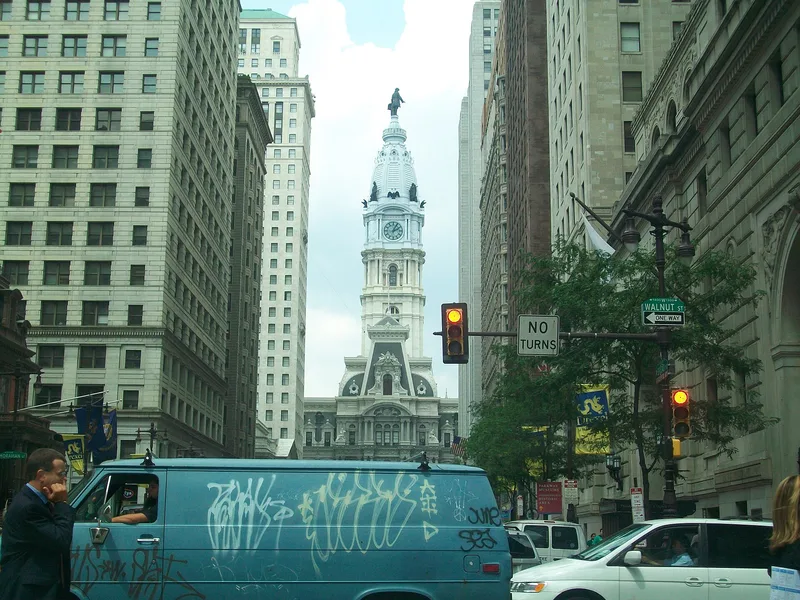
Broad Street, laid out in Thomas Holme's plan for Philadelphia, runs through the city's center from Cherry to Pine Street and forms a district of civic, financial, commercial and cultural buildings. The first surviving building is John Haviland's Pennsylvania Asylum for the Deaf and Dumb of 1824, a Greek temple design that set the institutional character of the street. Churches, clubs and academies followed in the 1840s and later, including the Union League of 1864 and James H. Windrim's Masonic Temple. After City Hall moved to Broad and Market Streets in the 1870s and 1880s, banks, insurance firms and trust companies built tall office towers along the street, among them the Land Title Towers, the Fidelity Bank and the Girard Trust building. Architects including Frank Furness, Horace Trumbauer, Simon and Simon, and John T. Windrim designed many of these buildings. The street is regarded as the principal concentration of tall buildings in the city.
Significance in brief: The nomination argues that the street, laid out in Thomas Holme's plan of Philadelphia, served as a civic and cultural boulevard in the 19th century and became the city's financial district after City Hall was moved to Broad and Market Streets. Its concentration of tall office buildings by notable architects, together with its cultural institutions and transportation role, is presented as representing the city's commercial and civic development.
Machine-generated summary. This summary was generated by a language model from the official nomination document and has not been reviewed line by line by an editor. It may contain errors. Check the source document before relying on any detail. Source: nomination document (PDF) · National Archives catalog entry. NRHP reference 84003529, listed April 6, 1984. Summary generated October 2026 (model claude-haiku-5-5, prompt v1.1-2026-10-29, confidence medium).
Key facts
| Address | Roughly bounded by Juniper, Cherry, 15th, and Pine Sts., Philadelphia |
|---|---|
| County | Philadelphia |
| Listed | April 6, 1984 |
| Reference number | 84003529 |
| Resource type | District |
| Period of significance | 1824-present |
| Criteria |
|
| Areas of significance | Commerce, Education, Politics/Government, Architecture |
| Level of significance | State |
| Acreage | 58 |
| Coordinates | 39.95010, -75.16451 (NPS GIS) |
What listing means for this property
This is a historic district. Buildings within its boundary are either contributing (they add to the district's significance) or non-contributing. Owners of contributing income-producing buildings can claim the 20% federal rehabilitation tax credit; homeowners should look at state credits. National Register districts impose no design review by themselves; a local historic district ordinance, if one exists, does (the difference explained).
General information, not legal or tax advice. Rules change; confirm with your State Historic Preservation Office or a qualified adviser.
Sources and further reading
- National Park Service, National Register of Historic Places database (snapshot May 2026), reference 84003529.
- Nomination form (PDF, National Archives) — catalog entry
- Wikipedia article (used for cross-checking only; text not reproduced here)
- Wikidata Q4971962
- This listing as JSON
Last updated October 2026. Found an error? See the editorial policy for how to report it.