South Loop Printing House District
Also known as: See Also:76000702; Dearborn Station; Manhatten Bldg.
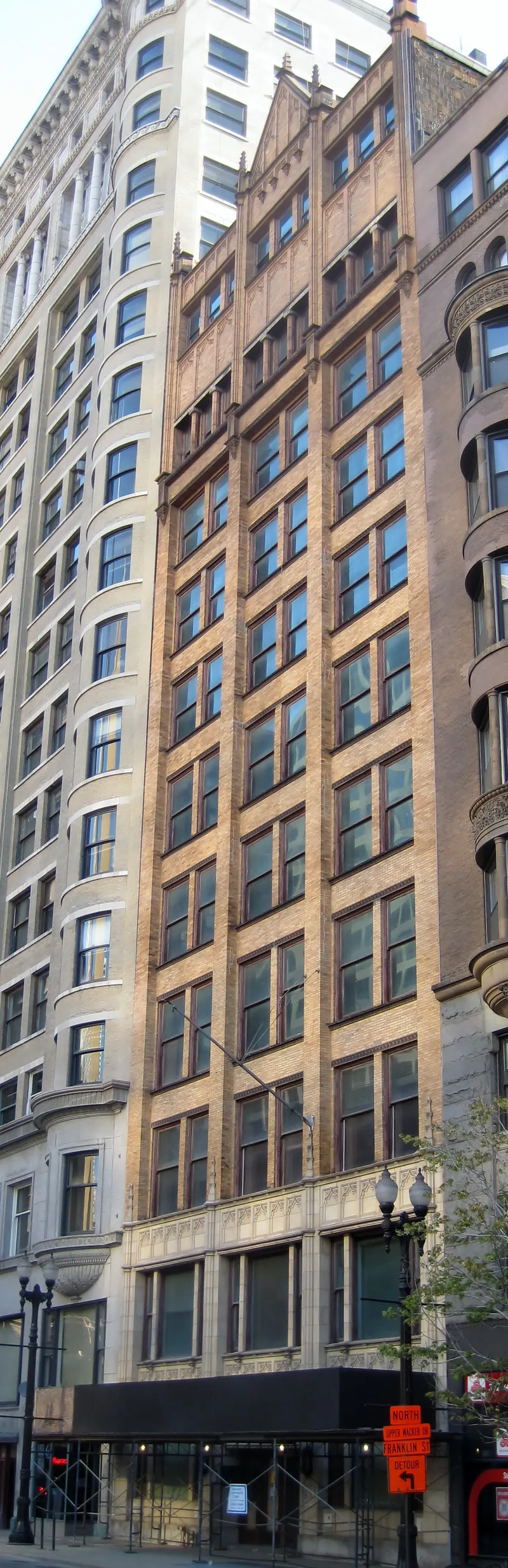

Why it's listed
Centered on South Dearborn Street near Dearborn Station, this Chicago district of about 43 acres preserves the buildings of the city's printing industry. Development began after the Great Fire of 1871 and accelerated in 1883, when the Donohue Building opened in anticipation of the station. The railroad gave printers freight access and a way to distribute books, catalogs and maps nationwide. Narrow blocks admitted light to tall buildings and allowed long rows of presses. Firms such as Donohue and Henneberry, Rand McNally and the Lakeside Press clustered here, supported by paper suppliers, binders, engravers and mapmakers. A second wave of building followed the 1903 LaSalle Street station, and six more buildings arrived in the mid-1920s. The architecture ranges from small post-fire brick lofts to Romanesque Revival plants, Chicago School towers such as the Pontiac Building, and concrete-frame structures. Many designers were prominent Chicago architects. Neglect after World War II left the district's fabric largely intact, and it was listed for its commercial, industrial and architectural character.
Significance in brief: The nomination argues the district embodies a commercial and industrial area that grew after the railroads were consolidated, and that it was the hub of Midwest printing for more than fifty years after 1883. Its urban form is a distinctive response to industrial needs: thin blocks give light and freight access. It also holds a fairly uniform group of buildings, many by noted Chicago School architects and of high design quality.
Machine-generated summary. This summary was generated by a language model from the official nomination document and has not been reviewed line by line by an editor. It may contain errors. Check the source document before relying on any detail. Source: nomination document (PDF) · National Archives catalog entry. NRHP reference 78001130, listed March 2, 1978. Summary generated October 2026 (model claude-sonnet-5-5, prompt v1.0-2026-10-29, confidence medium).
Key facts
| Address | Roughly bounded by Taylor, Polk, Wells, Congress and State Sts., Chicago |
|---|---|
| County | Cook County |
| Listed | March 2, 1978 |
| Reference number | 78001130 |
| Resource type | District |
| Period of significance | 1883-1928 |
| Architect / builder | Multiple, including C.L. Eidlitz (Dearborn Station), Julius Speyer and A.S. Alschuler (Donohue Building), George C. Nimmons (Franklin Building), Fred V. Prather (Transportation Building), Holabird and Roche (Pontiac Building), Jenney and Mundie (Morton Building), J.M. Van Osdel (Terminals Building) |
| Architectural style | Romanesque Revival, Chicago School and later concrete-frame functional loft buildings |
| Areas of significance | Industry, Commerce, Transportation, Architecture, Communications |
| Level of significance | National |
| Status (as stated in the nomination) | Described as remaining largely as constructed and still occupied by commercial printing concerns; condition marked fair. |
| Acreage | 43 |
| Coordinates | 41.87403, -87.63096 (NPS GIS) |
What listing means for this property
This is a historic district. Buildings within its boundary are either contributing (they add to the district's significance) or non-contributing. Owners of contributing income-producing buildings can claim the 20% federal rehabilitation tax credit; homeowners should look at state credits. National Register districts impose no design review by themselves; a local historic district ordinance, if one exists, does (the difference explained).
General information, not legal or tax advice. Rules change; confirm with your State Historic Preservation Office or a qualified adviser.
Sources and further reading
- National Park Service, National Register of Historic Places database (snapshot May 2026), reference 78001130.
- Nomination form (PDF, National Archives) — catalog entry
- Wikipedia article (used for cross-checking only; text not reproduced here)
- Wikidata Q7567860
- This listing as JSON
Last updated October 2026. Found an error? See the editorial policy for how to report it.