Chicago Harbor Lighthouse

Why it's listed
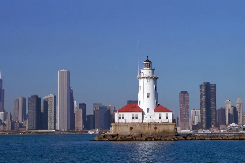
Chicago Harbor Lighthouse marks the entrance to Chicago Harbor from the south end of the north arm of the outer breakwater. It was first built in 1893, and Congress appropriated $88,000 in 1917 to move it to the newly built breakwater section, work completed in 1918-1919. The structure rests on a concrete pier measuring 44 by 65 feet and 20 feet high. Its brick-lined cast iron tower is 18 feet in diameter and 48 feet high to the base of the watchroom, topped by a ten-sided cast iron lantern. A 28-foot-square fog signal building sits on one side of the tower and an 18-by-28-foot boathouse on the other, both with hipped roofs. The light has a focal plane of 82 feet above mean lower water. The original Third Order Fresnel lens and fog signal equipment are gone. The lighthouse was recognized for its role in the development of the port of Chicago and for its evolutionary lighthouse design, and it remains in use as a harbor light and fog signal.
Significance in brief: The lighthouse is described as having played an important role in the development of the port of Chicago. The Illinois State Historic Preservation Officer also cited its significance in the growth of navigation on the Great Lakes and its evolutionary design in lighthouse architecture.
Machine-generated summary. This summary was generated by a language model from the official nomination document and has not been reviewed line by line by an editor. It may contain errors. Check the source document before relying on any detail. Source: nomination document (PDF) · National Archives catalog entry. NRHP reference 84000986, listed July 19, 1984. Summary generated October 2026 (model claude-sonnet-5-5, prompt v1.0-2026-10-29, confidence low).
Key facts
| Address | N Breakwater, Chicago |
|---|---|
| County | Cook County |
| Listed | July 19, 1984 |
| Reference number | 84000986 |
| Resource type | Building |
| Areas of significance | Engineering |
| Level of significance | State |
| Status (as stated in the nomination) | Still used as a harbor light and fog signal; the original lens and fog signal equipment are no longer extant. Interior noted as intact. |
| Acreage | 1 |
| Coordinates | 41.88937, -87.59067 (NPS GIS) |
What listing means for this property
For a publicly owned building or structure, listing mainly matters when federal funds, permits or licences are involved: projects then go through Section 106 review so effects on the property are considered. Listing also strengthens applications for preservation grants and, for leased income-producing uses, can enable the federal rehabilitation tax credit.
General information, not legal or tax advice. Rules change; confirm with your State Historic Preservation Office or a qualified adviser.
Sources and further reading
- National Park Service, National Register of Historic Places database (snapshot May 2026), reference 84000986.
- Nomination form (PDF, National Archives) — catalog entry
- Wikipedia article (used for cross-checking only; text not reproduced here)
- Wikidata Q5095636
- This listing as JSON
Last updated October 2026. Found an error? See the editorial policy for how to report it.