Suffolk Historic District (Boundary Increase II)
Also known as: VDHR File No. 133-0072

Why it's listed
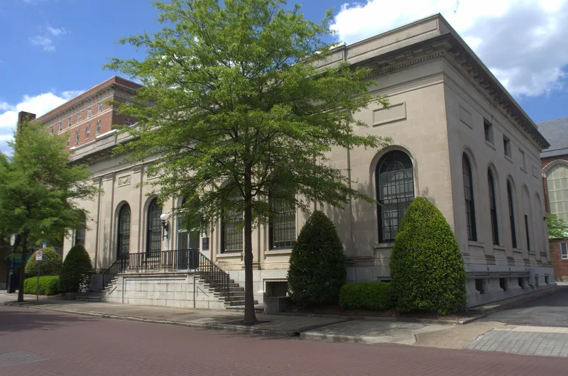
This boundary expansion brings the blocks south of Market and Bank Streets in downtown Suffolk, Virginia, into the Suffolk Historic District. The roughly 52-acre area holds 141 resources, including brick commercial buildings, warehouses, banks, two railroad depots, service stations, a courthouse and small groups of houses along Clay, Pinner and Liberty Streets. Most storefronts date from the early 20th century and show Italianate, Colonial Revival or plain commercial forms, with large plate-glass display windows and recessed entries. Taller landmarks include the seven-story Renaissance Revival National Bank of Suffolk and the Classical Revival Jones Building. The railroad shaped the area's growth, and a wooden depot from the late 19th century and a Tudor Revival depot survive. The area was found to share the original district's development and styles and to retain integrity. It was added for its architecture, commerce, industry and transportation, and the district's period of significance now runs to 1950.
Significance in brief: The nomination argues the area is analogous to the existing district in its period of development and architectural styles and retains enough integrity to justify expansion. It is significant under criteria A and C for its architecture, commerce, industry and transportation, with railroads central to the city's growth. The increase extends the district's period of significance to 1950.
Machine-generated summary. This summary was generated by a language model from the official nomination document and has not been reviewed line by line by an editor. It may contain errors. Check the source document before relying on any detail. Source: nomination document (PDF) · National Archives catalog entry. NRHP reference 02000976, listed September 14, 2002. Summary generated October 2026 (model claude-sonnet-5-5, prompt v1.0-2026-10-29, confidence medium).
Key facts
| Address | Roughly bounded by N and W RR tracks, County St., and Liberty St., Bank St., Market St., Clay St. and Poplar Sts., Suffolk (Independent City) |
|---|---|
| County | Suffolk |
| Listed | September 14, 2002 |
| Reference number | 02000976 |
| Resource type | District |
| Period of significance | 1785-1950 |
| Architect / builder | Unknown |
| Architectural style | Late Victorian (Queen Anne, Italianate, Second Empire, Gothic Revival, Renaissance Revival), Colonial Revival, Classical Revival, Tudor Revival, Modern Movement and Commercial Style |
| Criteria |
|
| Areas of significance | Architecture, Commerce, Industry, Transportation |
| Level of significance | Local |
| Status (as stated in the nomination) | Of 141 resources, 114 are contributing and 27 are non-contributing. Many buildings remain in commercial and residential use. |
| Acreage | 52.6 |
| Within district | Suffolk Historic District |
| Coordinates | 36.72796, -76.58187 (NPS GIS) |
What listing means for this property
This is a historic district. Buildings within its boundary are either contributing (they add to the district's significance) or non-contributing. Owners of contributing income-producing buildings can claim the 20% federal rehabilitation tax credit; homeowners should look at state credits. National Register districts impose no design review by themselves; a local historic district ordinance, if one exists, does (the difference explained).
General information, not legal or tax advice. Rules change; confirm with your State Historic Preservation Office or a qualified adviser.
Sources and further reading
- National Park Service, National Register of Historic Places database (snapshot May 2026), reference 02000976.
- Nomination form (PDF, National Archives) — catalog entry
- Wikipedia article (used for cross-checking only; text not reproduced here)
- Wikidata Q16900838
- This listing as JSON
Last updated October 2026. Found an error? See the editorial policy for how to report it.