Old Point Comfort Lighthouse

Why it's listed
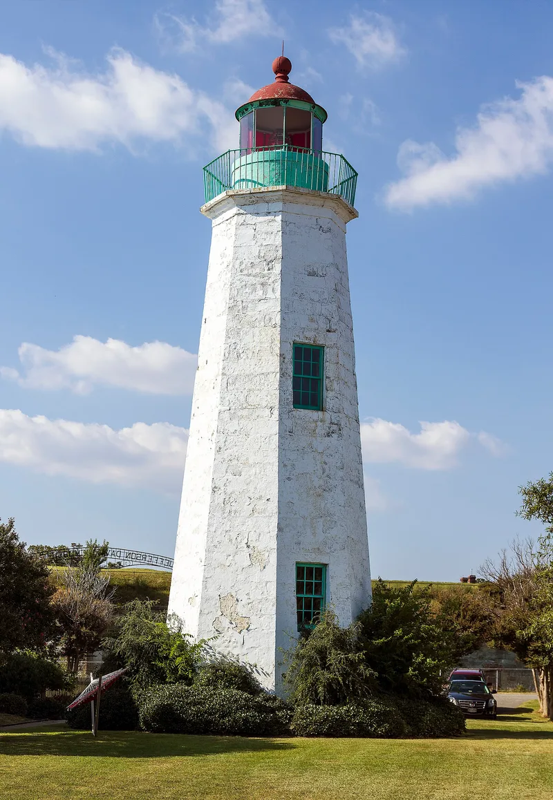
Guarding the north side of the entrance to Hampton Roads, this octagonal stone lighthouse was completed in 1802 at Old Point Comfort. It rises forty-seven feet and is built of tapered ashlar masonry, with stone moldings at the base and top and a spiral stair whose wedge-shaped steps are keyed into the wall. Regular whitewashing keeps it looking fresh. A two-story frame lightkeeper's house, added around 1900, stands beside it. The site had a light before the tower: after Fort George was destroyed by a hurricane in 1749, caretaker John Dames reportedly operated a guiding light, and the colonial Assembly paid him a salary in 1775. Virginia conveyed land to the federal government in 1798 for a permanent lighthouse. Fort Monroe later rose just behind it, and in 1837 Congress approved money to move the tower inside the fort, though the move never happened. Federal forces held the lighthouse during the Civil War. Its twin at New Point Comfort is abandoned, while this tower remains in excellent condition and in service.
Significance in brief: The tower is the lighthouse the federal government built in 1802 to replace an earlier locally run light guiding ships into Hampton Roads. It is in excellent condition and still works as a round-the-clock navigation aid. It stood near the 1862 clash of the ironclads Monitor and Virginia, and its twin at New Point Comfort is abandoned.
Machine-generated summary. This summary was generated by a language model from the official nomination document and has not been reviewed line by line by an editor. It may contain errors. Check the source document before relying on any detail. Source: nomination document (PDF) · National Archives catalog entry. NRHP reference 73002212, listed March 1, 1973. Summary generated October 2026 (model claude-sonnet-5-5, prompt v1.0-2026-10-29, confidence high).
Key facts
| Address | Fenwick Rd., SW of E gate of Fort Monroe, Hampton (Independent City) |
|---|---|
| County | Hampton |
| Listed | March 1, 1973 |
| Reference number | 73002212 |
| Resource type | Building |
| Period of significance | 19th Century (specific date 1802) |
| Areas of significance | Transportation, Architecture |
| Level of significance | State |
| Status (as stated in the nomination) | Listed in excellent condition; the light still operates as a round-the-clock nautical aid. The form shows the property as public, government-owned and occupied, with preservation work in progress. |
| Acreage | 9.9 |
| Within district | Fort Monroe |
| Coordinates | 37.00179, -76.30650 (NPS GIS) |
What listing means for this property
For a publicly owned building or structure, listing mainly matters when federal funds, permits or licences are involved: projects then go through Section 106 review so effects on the property are considered. Listing also strengthens applications for preservation grants and, for leased income-producing uses, can enable the federal rehabilitation tax credit.
General information, not legal or tax advice. Rules change; confirm with your State Historic Preservation Office or a qualified adviser.
Sources and further reading
- National Park Service, National Register of Historic Places database (snapshot May 2026), reference 73002212.
- Nomination form (PDF, National Archives) — catalog entry
- Wikipedia article (used for cross-checking only; text not reproduced here)
- Wikidata Q7084747
- This listing as JSON
Last updated October 2026. Found an error? See the editorial policy for how to report it.