Fort Wool
Also known as: Fort Calhoun

Why it's listed
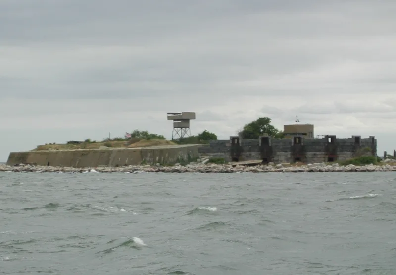
Built on a fifteen-acre island of large granite blocks at the mouth of Hampton Roads, Fort Wool began in 1819 as Fort Calhoun. It was part of a coastal defense plan devised by Secretary of War George Graham that also produced Fort Monroe. Work proceeded slowly until the Civil War, and Robert E. Lee supervised part of the construction. By 1861 the lower tier held fifty-two casemates and 187 men were stationed there. The fort was renamed in 1862 for Major General John Wool, and President Lincoln watched Union troops embark from it to seize Norfolk. After going ungarrisoned from 1886 until World War I, it served again in both World Wars. Surviving features include the western ramparts, Civil War batteries, powder and storage rooms, and World War I and II towers and a command post. Abandoned by 1953 and returned to Virginia in 1967, it stands as a ruin valued for its varied military architecture and harbor setting.
Significance in brief: The fort was part of the early nineteenth-century coastal defense plan that also included Fort Monroe. Robert E. Lee supervised part of its construction, and President Lincoln watched Union troops embark from it to seize Norfolk. It was reactivated in both World Wars and shows a wide variety of military architecture.
Machine-generated summary. This summary was generated by a language model from the official nomination document and has not been reviewed line by line by an editor. It may contain errors. Check the source document before relying on any detail. Source: nomination document (PDF) · National Archives catalog entry. NRHP reference 69000339, listed November 25, 1969. Summary generated October 2026 (model claude-sonnet-5-5, prompt v1.0-2026-10-29, confidence medium).
Key facts
| Address | Island between Willoughby Spit and Old Point Comfort, Hampton (Independent City) |
|---|---|
| County | Hampton |
| Listed | November 25, 1969 |
| Reference number | 69000339 |
| Resource type | District |
| Areas of significance | Military, Architecture |
| Level of significance | State |
| Status (as stated in the nomination) | Described as abandoned and in a decaying, ruinous state; returned to the Commonwealth of Virginia in 1967 and proposed to be developed as a recreation area. |
| Coordinates | 36.98657, -76.30037 (NPS GIS) |
What listing means for this property
This is a historic district. Buildings within its boundary are either contributing (they add to the district's significance) or non-contributing. Owners of contributing income-producing buildings can claim the 20% federal rehabilitation tax credit; homeowners should look at state credits. National Register districts impose no design review by themselves; a local historic district ordinance, if one exists, does (the difference explained).
Noted as vacant in the nomination. Nomination documents can be decades old; current status may differ. If you are considering buying an empty listed property, read the due-diligence checklist.
General information, not legal or tax advice. Rules change; confirm with your State Historic Preservation Office or a qualified adviser.
Sources and further reading
- National Park Service, National Register of Historic Places database (snapshot May 2026), reference 69000339.
- Nomination form (PDF, National Archives) — catalog entry
- Wikipedia article (used for cross-checking only; text not reproduced here)
- Wikidata Q5472371
- This listing as JSON
Last updated October 2026. Found an error? See the editorial policy for how to report it.