New York Marble Cemetery

Why it's listed
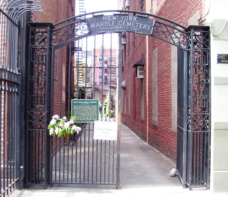
Hidden inside a Lower East Side block between East 2nd and 3rd Streets, Second Avenue and the Bowery, this half-acre cemetery cannot be seen from the street. Entry is through an iron-gated alley between Nos. 41 and 43 Second Avenue. There are no monuments or tombstones: all 156 burial vaults, built of Tuckahoe marble, lie underground beneath a lawn, and marble tablets set in the north and south walls record vault numbers and original owners. The cemetery followed an 1830 city ordinance banning burials below Canal Street. Three businessmen, Perkins Nichols, Anthony Dey and George W. Strong, bought land from Henry Eckford, built the vaults and sold them to leading families; the corporation was chartered in 1831. Buyers and later burials include Valentine Mott, the Scribners, Peter Lorillard II, Aaron Clark and James Talmadge. It was Manhattan's first non-sectarian public burial ground and is one of two Manhattan cemeteries still unchanged in size and shape. The grounds are fairly well kept, though the surrounding wall is crumbling in places.
Significance in brief: It was Manhattan's first non-sectarian burial ground open to the public and was used by some of New York's oldest families. It is also notable because it keeps its original, unusual design of underground vaults marked only by wall tablets. It is one of two cemeteries in Manhattan still unchanged in size and shape.
Machine-generated summary. This summary was generated by a language model from the official nomination document and has not been reviewed line by line by an editor. It may contain errors. Check the source document before relying on any detail. Source: nomination document (PDF) · National Archives catalog entry. NRHP reference 80004475, listed September 17, 1980. Summary generated October 2026 (model claude-sonnet-5-5, prompt v1.0-2026-10-29, confidence high).
Key facts
| Address | Between East 2nd and 3rd Sts.,2nd Ave. and Bowery, New York |
|---|---|
| County | Manhattan |
| Listed | September 17, 1980 |
| Reference number | 80004475 |
| Resource type | Site |
| Period of significance | 1830-1832 |
| Areas of significance | Community Planning and Development, Exploration/Settlement, Architecture |
| Level of significance | Local |
| Status (as stated in the nomination) | Grounds and plantings are fairly well kept, but the surrounding wall has deteriorated, with the western part of the north wall crumbling; the tombs remain undisturbed. Form lists condition as deteriorated and unaltered, status occupied, use cemetery. |
| Acreage | 0.9 |
| Coordinates | 40.73467, -73.99107 (NPS GIS) |
What listing means for this property
Sites (archaeological sites, battlefields, landscapes) are often listed with a restricted address to protect them from looting or disturbance. Listing is honorary for private owners; federal undertakings on or near the site go through Section 106 review, and state laws may protect burials and artefacts regardless of listing.
General information, not legal or tax advice. Rules change; confirm with your State Historic Preservation Office or a qualified adviser.
Sources and further reading
- National Park Service, National Register of Historic Places database (snapshot May 2026), reference 80004475.
- Nomination form (PDF, National Archives) — catalog entry
- Wikipedia article (used for cross-checking only; text not reproduced here)
- Wikidata Q2879976
- This listing as JSON
Last updated October 2026. Found an error? See the editorial policy for how to report it.