Eastern Parkway

Why it's listed
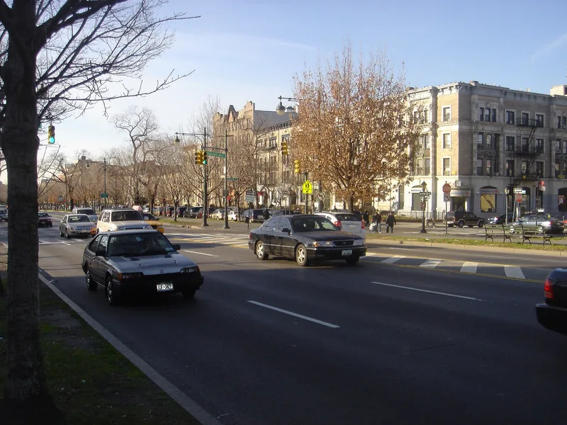
Eastern Parkway is a three-mile boulevard in Brooklyn between Grand Army Plaza and Ralph Avenue, built from 1870 to 1874. Frederick Law Olmsted and Calvert Vaux designed it as a new kind of street, with central malls of trees, a carriage drive, walkways and separate service roads, meant to extend the feel of Prospect Park through the city. It was the first of Olmsted's parkways to be finished, and the nomination credits him with coining the word "parkway." At its widest the road is 210 feet across, divided into three roadways by two tree-lined malls holding about one thousand trees, roughly half of them elms. The plan also included flanking boulevards and setback rules for houses, though development came slowly and the rules were loosely applied. The parkway later attracted the Brooklyn Botanical Garden, the Brooklyn Public Library and many religious institutions, and it has hosted parades from 1909 to the West Indian-American Day Carnival.
Significance in brief: It was the first of Olmsted's parkways to be completed, and the form says Olmsted invented the term "parkway." It combined malls with trees, pleasure drives, walkways and service roads to carry the character of Prospect Park through Brooklyn. It was also planned as part of a designed residential neighborhood and has drawn cultural institutions and major parades.
Machine-generated summary. This summary was generated by a language model from the official nomination document and has not been reviewed line by line by an editor. It may contain errors. Check the source document before relying on any detail. Source: nomination document (PDF) · National Archives catalog entry. NRHP reference 83001689, listed September 26, 1983. Summary generated October 2026 (model claude-sonnet-5-5, prompt v1.0-2026-10-29, confidence high).
Key facts
| Address | Eastern Pkwy from Grand Army Plaza to Ralph Ave., New York |
|---|---|
| County | Brooklyn |
| Listed | September 26, 1983 |
| Reference number | 83001689 |
| Resource type | Structure |
| Period of significance | 1870-74 |
| Architect / builder | Frederick Law Olmsted & Calvert Vaux |
| Areas of significance | Community Planning and Development, Landscape Architecture |
| Level of significance | National |
| Status (as stated in the nomination) | Public roadway in use as a major city thoroughfare and park; the form says the original width of the malls has been reduced but the parkway's character has been maintained. |
| Acreage | 61 |
| Within district | Prospect Park |
| Coordinates | 40.67163, -73.96847 (NPS GIS) |
What listing means for this property
National Register listing is honorary: it recognises significance and does not restrict what a private owner may do without federal money or permits. It unlocks the 20% federal rehabilitation tax credit for income-producing buildings, state credits in many states, and Section 106 review when federal agencies are involved. See what listing means in practice.
General information, not legal or tax advice. Rules change; confirm with your State Historic Preservation Office or a qualified adviser.
Sources and further reading
- National Park Service, National Register of Historic Places database (snapshot May 2026), reference 83001689.
- Nomination form (PDF, National Archives) — catalog entry
- Wikipedia article (used for cross-checking only; text not reproduced here)
- Wikidata Q2488389
- This listing as JSON
Last updated October 2026. Found an error? See the editorial policy for how to report it.