Underground Atlanta Historic District
Also known as: Underground Atlanta; Underground; See Also:Western and Altanti
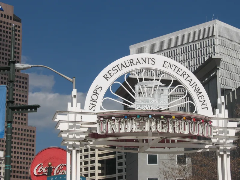

Why it's listed
Underground Atlanta is a downtown district where the street level was raised by one story, leaving older ground-floor shops below the city. It includes about two blocks of brick commercial buildings from the late 1800s and early 1900s, mostly Victorian with some Neoclassical and Functional designs. Concrete viaducts built in 1928-29 over Central Avenue, Pryor, Alabama and Wall streets lifted traffic above the railroad gulch that had divided the city. Stores along Alabama Street became basements, with new entrances built at the higher level. The district also holds the 1869 Georgia Railroad Freight Depot, an Italianate red-brick building that is the oldest surviving structure in the central business district, and the 1850 Zero Mile Post of the Western and Atlantic Railroad. Its significance rests on how these elements show Atlanta's change from a railroad and walking town to an automobile city. Renovation beginning in 1968 and later MARTA rail construction altered parts of the area, though many iron-column facades remain.
Significance in brief: The district records Atlanta's growth from a railroad and pedestrian town into an automobile-oriented city. The 1928-29 viaducts raised the streets one story and left the original ground-floor stores underground. The 1869 freight depot is the oldest extant building in the Central Business District and the last downtown railroad building. The form does not state the criteria or period of significance in the surviving text.
Machine-generated summary. This summary was generated by a language model from the official nomination document and has not been reviewed line by line by an editor. It may contain errors. Check the source document before relying on any detail. Source: nomination document (PDF) · National Archives catalog entry. NRHP reference 80001077, listed July 24, 1980. Summary generated October 2026 (model claude-sonnet-5-5, prompt v1.0-2026-10-29, confidence medium).
Key facts
| Address | Roughly bounded by Martin Luther King, Jr., Dr., Central Ave., Wall and Peachtree Sts., Atlanta |
|---|---|
| County | Fulton County |
| Listed | July 24, 1980 |
| Reference number | 80001077 |
| Resource type | District |
| Architect / builder | Viaducts designed by Walter F. Shulz, consulting engineer, and built by the MacDougald Construction Company; Century Building by Bruce and Morgan (demolished) |
| Architectural style | Generally Victorian, with some Neoclassical and Functional examples; freight depot is Italianate |
| Areas of significance | Community Planning and Development, Commerce, Engineering, Transportation, Architecture |
| Level of significance | State |
| Status (as stated in the nomination) | Condition listed as fair and altered, on its original site. The form records 1968-72 conversion of underground stores to retail and restaurants, and MARTA construction that demolished buildings on the north side of Alabama Street. |
| Acreage | 12 |
| Coordinates | 33.75211, -84.38929 (NPS GIS) |
What listing means for this property
This is a historic district. Buildings within its boundary are either contributing (they add to the district's significance) or non-contributing. Owners of contributing income-producing buildings can claim the 20% federal rehabilitation tax credit; homeowners should look at state credits. National Register districts impose no design review by themselves; a local historic district ordinance, if one exists, does (the difference explained).
General information, not legal or tax advice. Rules change; confirm with your State Historic Preservation Office or a qualified adviser.
Sources and further reading
- National Park Service, National Register of Historic Places database (snapshot May 2026), reference 80001077.
- Nomination form (PDF, National Archives) — catalog entry
- Wikipedia article (used for cross-checking only; text not reproduced here)
- Wikidata Q7883623
- This listing as JSON
Last updated October 2026. Found an error? See the editorial policy for how to report it.