Long Marsh Run Rural Historic District
Also known as: VDHR File No. 21-967; See Also:Wickliffe Church; See Also:Fair

Why it's listed
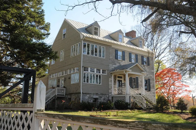
Spread across about sixteen square miles of rolling limestone farmland in north central Clarke County, this rural district looks toward the Blue Ridge Mountains and remains largely farmed. Roughly sixty farm and estate complexes make up its core, alongside four schools, four churches, two mills, a post office and several small African-American communities. Settlement began in the 1730s and 1740s under the Hite and Fairfax land grants. Early landowners, including the Washington and Larue families, built stone and brick houses that echo Tidewater Virginia. Fairfield, dated to about 1770, is the district's earliest surviving building and its best example of a Georgian plantation house. Stone mills along Long Marsh Run reflect wheat's rise as a cash crop. Later farmhouses show Federal, Greek Revival and Colonial Revival influences. Of 626 resources counted, 366 contribute to the district's character, and modern intrusions are described as few and inconspicuous.
Significance in brief: The nomination argues the district keeps an unusually intact agricultural landscape of limestone soils, fields, fences and farm complexes. Its estates and vernacular buildings reflect Tidewater-influenced settlement by families such as the Washingtons and Larues. It also has a higher concentration of resources tied to agriculture, education, industry and African-American heritage than other parts of the county.
Machine-generated summary. This summary was generated by a language model from the official nomination document and has not been reviewed line by line by an editor. It may contain errors. Check the source document before relying on any detail. Source: nomination document (PDF) · National Archives catalog entry. NRHP reference 96001173, listed November 4, 1996. Summary generated October 2026 (model claude-sonnet-5-5, prompt v1.0-2026-10-29, confidence medium).
Key facts
| Address | Roughly bounded by WV state line, VA 608, VA 612, VA 7, and VA 653, Berryville |
|---|---|
| County | Clarke County |
| Listed | November 4, 1996 |
| Reference number | 96001173 |
| Resource type | District |
| Architectural style | Georgian, Federal, Early Classical Revival, Greek Revival, Italianate, Colonial Revival, Bungalow/Craftsman, and vernacular forms such as I-house and hall-parlor plan |
| Areas of significance | Architecture, Agriculture, Education, Industry, Black |
| Level of significance | Local |
| Status (as stated in the nomination) | Primarily used for farming and residences; about 43% of the land is in the county Agricultural District and 360 acres are under open-space easements. Some mills have been converted to barns or are in ruins. |
| Acreage | 10293 |
| Coordinates | 39.15546, -77.92700 (NPS GIS) |
What listing means for this property
This is a historic district. Buildings within its boundary are either contributing (they add to the district's significance) or non-contributing. Owners of contributing income-producing buildings can claim the 20% federal rehabilitation tax credit; homeowners should look at state credits. National Register districts impose no design review by themselves; a local historic district ordinance, if one exists, does (the difference explained).
General information, not legal or tax advice. Rules change; confirm with your State Historic Preservation Office or a qualified adviser.
Sources and further reading
- National Park Service, National Register of Historic Places database (snapshot May 2026), reference 96001173.
- Nomination form (PDF, National Archives) — catalog entry
- Wikipedia article (used for cross-checking only; text not reproduced here)
- Wikidata Q14712741
- This listing as JSON
Last updated October 2026. Found an error? See the editorial policy for how to report it.