Cherrydale Historic District
Also known as: VDHR File Number 000-7821

The pin is a point inside the NPS boundary polygon, not a surveyed location.
Why it's listed
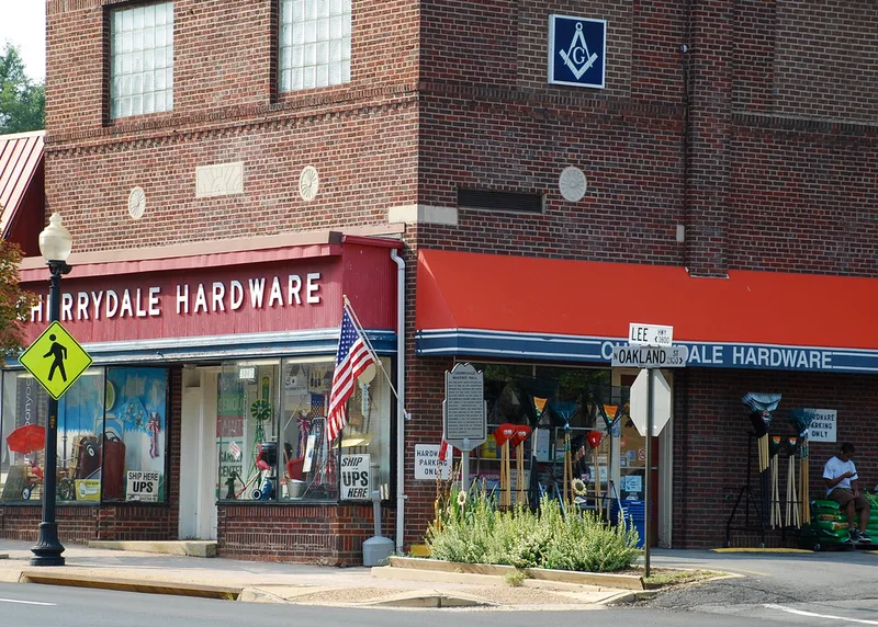
Cherrydale is a suburban neighborhood in central Arlington County, Virginia, about three and a half miles from Washington, D.C. The historic district holds 887 properties, including 829 single-family houses, twenty-seven multiple dwellings, four churches with a church school, twenty-two commercial buildings, a fire station and a meeting hall. Development began with Schutt family land along what are now Lee Highway and North Quincy Street, and twenty-two subdivisions followed between 1905 and 1926. Most houses are wood frame, though locally made concrete block was widely used for foundations and structures by the 1920s. Styles are modest and suburban in scale, including Queen Anne, Colonial Revival, Italianate and Tudor Revival, with bungalows the most popular form in the 1910s and 1920s. Some homes were mail-order kits, including a Sears house on Stafford Street. The district is significant as a record of how a rural crossroads grew into a self-sufficient streetcar-era and automobile-era suburb by 1953.
Significance in brief: The form describes a largely intact early-to-mid 20th-century suburb of 887 properties, mostly single-family houses in modest suburban versions of Queen Anne, Colonial Revival, Craftsman bungalow and other styles. It documents the platting and growth of Cherrydale from the late 1800s through 1953 as a self-sufficient suburb of Washington. The certifying official recommended local significance.
Machine-generated summary. This summary was generated by a language model from the official nomination document and has not been reviewed line by line by an editor. It may contain errors. Check the source document before relying on any detail. Source: nomination document (PDF) · National Archives catalog entry. NRHP reference 03000461, listed May 22, 2003. Summary generated October 2026 (model claude-sonnet-5-5, prompt v1.0-2026-10-29, confidence medium).
Key facts
| Address | Roughly bounded by Lorcom Ln., N. Utah and N. Taylor Sts., and I-66, Arlington |
|---|---|
| County | Arlington County |
| Listed | May 22, 2003 |
| Reference number | 03000461 |
| Resource type | District |
| Architectural style | Late Victorian (Queen Anne, Gothic Revival, Italianate), Colonial Revival, Tudor Revival, Bungalow/Craftsman, Mission/Spanish Colonial Revival, and Modern Movement/International |
| Areas of significance | Architecture, Community Planning and Development |
| Level of significance | Local |
| Status (as stated in the nomination) | Still largely residential, with continuing commercial, religious, school, fire station and meeting hall uses; contributing and noncontributing resources are both counted. |
| Acreage | 286.3 |
| Coordinates | 38.89333, -77.11115 (NPS GIS) |
What listing means for this property
This is a historic district. Buildings within its boundary are either contributing (they add to the district's significance) or non-contributing. Owners of contributing income-producing buildings can claim the 20% federal rehabilitation tax credit; homeowners should look at state credits. National Register districts impose no design review by themselves; a local historic district ordinance, if one exists, does (the difference explained).
General information, not legal or tax advice. Rules change; confirm with your State Historic Preservation Office or a qualified adviser.
Sources and further reading
- National Park Service, National Register of Historic Places database (snapshot May 2026), reference 03000461.
- Nomination form (PDF, National Archives) — catalog entry
- Wikipedia article (used for cross-checking only; text not reproduced here)
- Wikidata Q14712162
- This listing as JSON
Last updated October 2026. Found an error? See the editorial policy for how to report it.