La Villita Historic District

Why it's listed
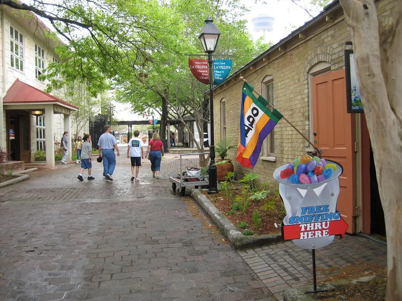
La Villita is a 15-acre district in San Antonio, four blocks from the Alamo and beside downtown, bounded by Durango, Navarro, Alamo and the San Antonio River. It holds twenty-seven notable buildings, mostly simple masonry houses of stucco-covered brick, adobe, caliche block or stone, along with a reconstructed palisado house, a church of 1876 and a German-English school begun in 1859. The site was once a Coahuiltecan village and later a Spanish-era barrio, with the name La Villita recorded in 1792. German immigrants arrived in the 1840s, followed by Swiss and French settlers, giving the quarter a European character. After decaying into a slum in the early twentieth century, it was restored in a two-year project begun in 1939 by the city, the San Antonio Conservation Society and the National Youth Administration. The district was listed for preserving a record of vernacular nineteenth-century Texas architecture and the layered cultures of San Antonio.
Significance in brief: The district is described as a European-type quarter reflecting the Spanish, European and American influences that shaped San Antonio. It preserves a visual record of simple vernacular building types of nineteenth-century Texas, including Mexican-era and German immigrant structures. A 1939 restoration by the city, the San Antonio Conservation Society and the National Youth Administration saved a sample of buildings once typical across the city.
Machine-generated summary. This summary was generated by a language model from the official nomination document and has not been reviewed line by line by an editor. It may contain errors. Check the source document before relying on any detail. Source: nomination document (PDF) · National Archives catalog entry. NRHP reference 72001350, listed January 20, 1972. Summary generated October 2026 (model claude-sonnet-5-5, prompt v1.0-2026-10-29, confidence high).
Key facts
| Address | Bounded by Durango, Navarro, Alamo Sts. and San Antonio River, San Antonio |
|---|---|
| County | Bexar County |
| Listed | January 20, 1972 |
| Reference number | 72001350 |
| Resource type | District |
| Period of significance | 19th Century |
| Architect / builder | Alfred Giles (added the 1881 Victorian front to the Manuel Yturri House) |
| Architectural style | Simple vernacular masonry (Mexican-Spanish and Germanic vernacular), with some Victorian buildings |
| Areas of significance | Architecture |
| Level of significance | State |
| Status (as stated in the nomination) | Condition marked excellent and altered; occupied by arts groups, offices and a museum use. Three buildings south of Villita Street are in poor condition and in danger of destruction. |
| Acreage | 15.5 |
| Coordinates | 29.42051, -98.48929 (NPS GIS) |
What listing means for this property
This is a historic district. Buildings within its boundary are either contributing (they add to the district's significance) or non-contributing. Owners of contributing income-producing buildings can claim the 20% federal rehabilitation tax credit; homeowners should look at state credits. National Register districts impose no design review by themselves; a local historic district ordinance, if one exists, does (the difference explained).
General information, not legal or tax advice. Rules change; confirm with your State Historic Preservation Office or a qualified adviser.
Sources and further reading
- National Park Service, National Register of Historic Places database (snapshot May 2026), reference 72001350.
- Nomination form (PDF, National Archives) — catalog entry
- Wikipedia article (used for cross-checking only; text not reproduced here)
- Wikidata Q6465837
- This listing as JSON
Last updated October 2026. Found an error? See the editorial policy for how to report it.