Mill Creek Historic District (Boundary Increase)

Why it's listed
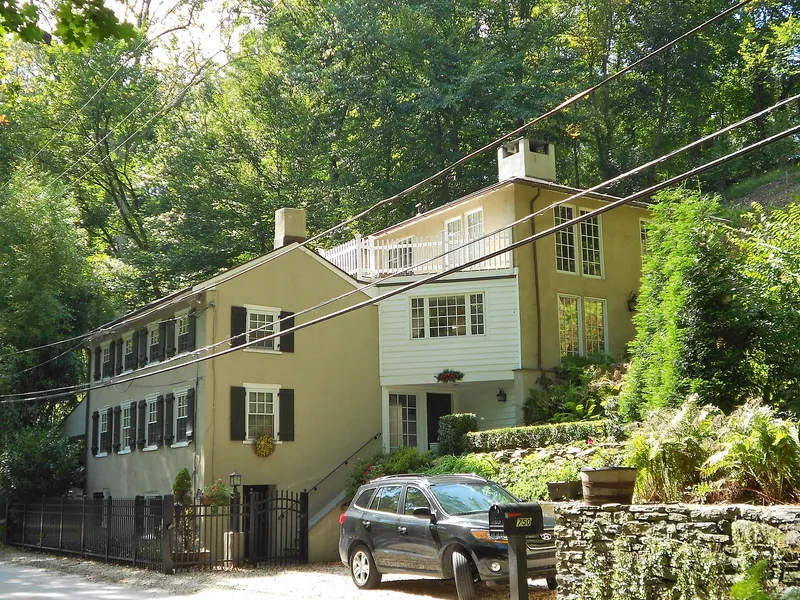
Along Mill Creek in Lower Merion Township, a wooded ravine about ten miles from central Philadelphia holds a cluster of water-powered mills, mill workers' houses and mill ruins dating from the eighteenth and nineteenth centuries. The creek's fall of roughly 250 feet made it a valuable source of power, and the earliest recorded mill was built by John Roberts. Christopher Robins constructed a mill here in 1758, and the Walover/Jones Mill complex, possibly dating to the same year, is the most intact of the mill communities. Paper was the main product in the eighteenth century, and later mills turned to gunpowder, lamp wicks, textiles and gun parts. Nippes began making long guns here in 1814. The district is also significant for its large estate houses and twentieth century residences, and for archaeological sites that may show how mill workers and owners lived.
Significance in brief: The document argues the district is important for its role in the milling industry, which produced paper, guns and textiles and helped make the Philadelphia region a center of industry, and for its archaeological sites. It is also significant architecturally for its mill complexes, large turn-of-the-century estate houses and 1920s to 1940s residences by architect Walter K. Durham.
Machine-generated summary. This summary was generated by a language model from the official nomination document and has not been reviewed line by line by an editor. It may contain errors. Check the source document before relying on any detail. Source: nomination document (PDF) · National Archives catalog entry. NRHP reference 96000965, listed August 30, 1996. Summary generated October 2026 (model claude-haiku-5-5, prompt v1.1-2026-10-29, confidence medium).
Key facts
| Address | Roughly bounded by the Schuylkill River, Mill Cr., Righter's Mill, Rose Glen, and Monk's Rds., Lower Merion Township, Gladwyne |
|---|---|
| County | Montgomery County |
| Listed | August 30, 1996 |
| Reference number | 96000965 |
| Resource type | District |
| Period of significance | C. 1758-1946 |
| Architect / builder | Price and McLanahan; Walter K. Durham (architect) |
| Architectural style | Colonial; Federal; Tudor Revival; Vernacular Mill Buildings |
| Criteria |
|
| Areas of significance | Historic - Non-Aboriginal, Industry, Architecture |
| Level of significance | Local |
| Acreage | 550 |
| Coordinates | 40.03136, -75.27489 (NPS GIS) |
What listing means for this property
This is a historic district. Buildings within its boundary are either contributing (they add to the district's significance) or non-contributing. Owners of contributing income-producing buildings can claim the 20% federal rehabilitation tax credit; homeowners should look at state credits. National Register districts impose no design review by themselves; a local historic district ordinance, if one exists, does (the difference explained).
General information, not legal or tax advice. Rules change; confirm with your State Historic Preservation Office or a qualified adviser.
Sources and further reading
- National Park Service, National Register of Historic Places database (snapshot May 2026), reference 96000965.
- Nomination form (PDF, National Archives) — catalog entry
- Wikipedia article (used for cross-checking only; text not reproduced here)
- Wikidata Q6858282
- This listing as JSON
Last updated October 2026. Found an error? See the editorial policy for how to report it.