African Jackson Cemetery

Why it's listed
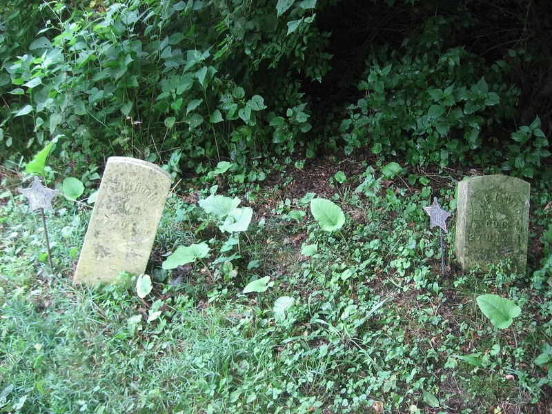
African Jackson Cemetery is a one-acre burial ground, roughly 360 by 120 feet, in the northern part of Piqua, Ohio. It was laid out in 128 plots with five east-west streets, and its graves date from the 1840s to the 1930s. An iron archway marks the west entrance, and a boulder with a bronze plaque commemorates the free Randolph slaves. The cemetery is tied to the Randolph Slave Settlement at Rossville. Nearly 600 slaves of Virginia statesman John Randolph were freed after litigation over his will ended in 1845, and about 383 came to Ohio in 1846. Hostile white settlers blocked their planned landing in Mercer County, and many eventually settled north of Piqua. Fires, demolitions and the 1913 flood reduced the settlement's houses, and alterations compromised those that remain. The cemetery still keeps its nineteenth-century appearance and has clear links to the freedmen, so it was selected as the best surviving resource of the community.
Significance in brief: It is the main surviving historic resource of the Randolph Slave Settlement, a freed black community established in the 1840s after John Randolph of Roanoke's slaves were freed by his contested will. Few such rural black settlements remain in Ohio, and Rossville is still an active community whose residents descend from the original freedmen. The cemetery was chosen because the surviving houses have serious integrity problems.
Machine-generated summary. This summary was generated by a language model from the official nomination document and has not been reviewed line by line by an editor. It may contain errors. Check the source document before relying on any detail. Source: nomination document (PDF) · National Archives catalog entry. NRHP reference 82001475, listed December 16, 1982. Summary generated October 2026 (model claude-sonnet-5-5, prompt v1.0-2026-10-29, confidence high).
Key facts
| Address | N of Piqua on Zimmerlin Rd., Piqua |
|---|---|
| County | Miami County |
| Listed | December 16, 1982 |
| Reference number | 82001475 |
| Resource type | Site |
| Period of significance | ca. 1847 to 1934 |
| Criteria |
|
| Areas of significance | Exploration/Settlement |
| Level of significance | State |
| Status (as stated in the nomination) | Described as generally cared for, with some stones vandalized or displaced; the few remaining gravestones are at the western end. It is owned by a local historical society. |
| Acreage | 1 |
| Coordinates | 40.15716, -84.23517 (NPS GIS) |
What listing means for this property
Sites (archaeological sites, battlefields, landscapes) are often listed with a restricted address to protect them from looting or disturbance. Listing is honorary for private owners; federal undertakings on or near the site go through Section 106 review, and state laws may protect burials and artefacts regardless of listing.
General information, not legal or tax advice. Rules change; confirm with your State Historic Preservation Office or a qualified adviser.
Sources and further reading
- National Park Service, National Register of Historic Places database (snapshot May 2026), reference 82001475.
- Nomination form (PDF, National Archives) — catalog entry
- Wikipedia article (used for cross-checking only; text not reproduced here)
- Wikidata Q4689802
- This listing as JSON
Last updated October 2026. Found an error? See the editorial policy for how to report it.