Mount Airy Forest

Why it's listed
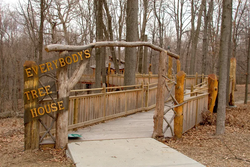
Mount Airy Forest is a 1,471-acre park roughly four miles northwest of downtown Cincinnati. The Cincinnati Park Board began buying worn-out farmland there in 1911 and started what is described as the first municipal reforestation project in the nation. Hardwoods, evergreens, meadows and an arboretum now cover land once scarred by erosion and grazing. Most construction took place between 1931 and 1959, much of it during the Depression with federal relief programs and Civilian Conservation Corps labor. The park holds eight open shelters, eight comfort stations, three lodges, a concession building, service buildings and a CCC camp that housed 200 African-American workers. Built of native stone and heavy timber, the structures follow a rustic style, and a dozen were designed by park architect R. Carl Freund. Interstate 74 divides the park and is counted as noncontributing, along with one recent shelter. The district includes 35 contributing resources.
Significance in brief: The nomination presents the forest as the nation's first municipal reforestation project, which turned eroded farmland into woodland. Nearly all of its facilities were built between 1931 and 1956, largely with Depression-era federal programs such as the CCC, WPA and CWA. Its buildings reflect a unified rustic park style, many designed by Park Board architect R. Carl Freund. It also includes a CCC camp staffed entirely by African-American workers.
Machine-generated summary. This summary was generated by a language model from the official nomination document and has not been reviewed line by line by an editor. It may contain errors. Check the source document before relying on any detail. Source: nomination document (PDF) · National Archives catalog entry. NRHP reference 10000191, listed April 13, 2010. Summary generated October 2026 (model claude-sonnet-5-5, prompt v1.0-2026-10-29, confidence medium).
Key facts
| Address | 5083 Colerain Ave., Cincinnati |
|---|---|
| County | Hamilton County |
| Listed | April 13, 2010 |
| Reference number | 10000191 |
| Resource type | District |
| Period of significance | 1911-1956 |
| Architect / builder | R. Carl Freund; E. L. Gill; H. Brunke; Felsberg & Gillespie; Joseph Stith; Civilian Conservation Corps labor |
| Architectural style | Other - Rustic park style |
| Areas of significance | Architecture, Landscape Architecture, Social History, Entertainment/Recreation |
| Level of significance | Local |
| Status (as stated in the nomination) | Still in use as a public park; the arboretum gardens were recently restored, and the former CCC camp has been used by the County Welfare Department since 1947. |
| Acreage | 1471 |
| Coordinates | 39.17380, -84.56605 (NPS GIS) |
What listing means for this property
This is a historic district. Buildings within its boundary are either contributing (they add to the district's significance) or non-contributing. Owners of contributing income-producing buildings can claim the 20% federal rehabilitation tax credit; homeowners should look at state credits. National Register districts impose no design review by themselves; a local historic district ordinance, if one exists, does (the difference explained).
General information, not legal or tax advice. Rules change; confirm with your State Historic Preservation Office or a qualified adviser.
Sources and further reading
- National Park Service, National Register of Historic Places database (snapshot May 2026), reference 10000191.
- Nomination form (PDF, National Archives) — catalog entry
- Wikipedia article (used for cross-checking only; text not reproduced here)
- Wikidata Q6919310
- This listing as JSON
Last updated October 2026. Found an error? See the editorial policy for how to report it.