City Cemetery

Why it's listed
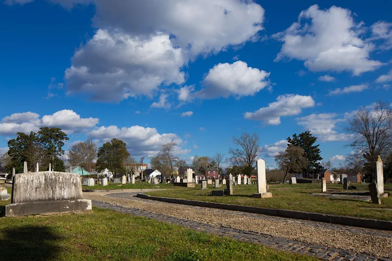
Raleigh's oldest public cemetery, City Cemetery occupies 7.46 acres east of downtown. It began in 1798 as a four-acre burying ground divided into four squares, with separate sections for city residents, strangers and African Americans. Later annexations brought it to its present size. About 2,100 burials are recorded, with death dates from 1795 to 2006. Graves are laid out east-west within family plots, many bordered by granite walls or cast-iron fences. A cast-iron fence originally made for Capitol Square was re-erected around three sides in 1898, and two granite mausolea date from the 1840s and about 1850. Monuments include headstones, box-tombs and obelisks, some carved by the Scottish stonecutter William Stronach, who came to build the State Capitol. The cemetery was listed for its social history and for one of North Carolina's finest collections of nineteenth-century funerary sculpture. Burials include governors, newspaper editors, ministers and early Raleigh families.
Significance in brief: The nomination argues statewide significance under Criterion A for social history as one of the first and finest municipal cemeteries in North Carolina, and under Criterion C for one of the state's finest collections of nineteenth-century funerary sculpture. It holds the graves of early Raleigh settlers, governors, editors, Confederate figures and the British stonecutters who built the State Capitol.
Machine-generated summary. This summary was generated by a language model from the official nomination document and has not been reviewed line by line by an editor. It may contain errors. Check the source document before relying on any detail. Source: nomination document (PDF) · National Archives catalog entry. NRHP reference 08000889, listed September 12, 2008. Summary generated October 2026 (model claude-sonnet-5-5, prompt v1.0-2026-10-29, confidence medium).
Key facts
| Address | 17 S. E. St., Raleigh |
|---|---|
| County | Wake County |
| Listed | September 12, 2008 |
| Reference number | 08000889 |
| Resource type | District |
| Criteria |
|
| Areas of significance | Social History, Art |
| Level of significance | State |
| Status (as stated in the nomination) | Still in use as a cemetery; burials date from 1795 to 2006, and many older monuments are weathered or fragmentary. |
| Acreage | 7.5 |
| Within district | Oakwood Historic District (Boundary Increase II) |
| Coordinates | 35.78075, -78.63213 (NPS GIS) |
What listing means for this property
This is a historic district. Buildings within its boundary are either contributing (they add to the district's significance) or non-contributing. Owners of contributing income-producing buildings can claim the 20% federal rehabilitation tax credit; homeowners should look at state credits. National Register districts impose no design review by themselves; a local historic district ordinance, if one exists, does (the difference explained).
General information, not legal or tax advice. Rules change; confirm with your State Historic Preservation Office or a qualified adviser.
Sources and further reading
- National Park Service, National Register of Historic Places database (snapshot May 2026), reference 08000889.
- Nomination form (PDF, National Archives) — catalog entry
- Wikipedia article (used for cross-checking only; text not reproduced here)
- Wikidata Q5123056
- This listing as JSON
Last updated October 2026. Found an error? See the editorial policy for how to report it.