Sleepy Hollow Cemetery

Why it's listed
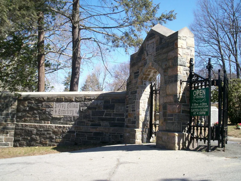
Sleepy Hollow Cemetery is a rural-style burial ground of about 85 acres in the village of Sleepy Hollow, New York, with winding drives, wooded hills, part of the Pocantico River and long views toward the Hudson. It was founded in 1849 as the Tarrytown Cemetery, an idea of Washington Irving and Captain Jacob Storm, and took its present name in 1865. Additional land was added in 1886 and 1890. The grounds hold roughly 45,000 burials and about 100 family mausoleums, along with monuments, a Collegiate Gothic chapel and gate from 1922-23, and works by architects and sculptors such as Richard Morris Hunt, Karl Bitter, Augustus Saint-Gaudens and Grosvenor Atterbury. The cemetery was recognized for its landscape design, architecture and funerary art, reflecting the rural cemetery movement. Its period of significance runs from 1849 to 1953, when the Lasker Mausoleum, the last major mausoleum, was built. The cemetery remains active today.
Significance in brief: The nomination argues it is an important mid-19th century example of a rural cemetery in New York State, with a dramatic hilly landscape and views of the Hudson River. It contains notable mausoleums, monuments and sculpture by well-known American architects and sculptors. It also holds the graves of many notable Americans.
Machine-generated summary. This summary was generated by a language model from the official nomination document and has not been reviewed line by line by an editor. It may contain errors. Check the source document before relying on any detail. Source: nomination document (PDF) · National Archives catalog entry. NRHP reference 09000380, listed June 3, 2009. Summary generated October 2026 (model claude-sonnet-5-5, prompt v1.0-2026-10-29, confidence medium).
Key facts
| Address | 540 N. Broadway, Sleepy Hollow |
|---|---|
| County | Westchester County |
| Listed | June 3, 2009 |
| Reference number | 09000380 |
| Resource type | District |
| Period of significance | 1849-1953 |
| Architect / builder | unknown (cemetery plan) |
| Architectural style | NO STYLE |
| Criteria |
|
| Areas of significance | Architecture, Landscape Architecture, Other |
| Level of significance | Local |
| Status (as stated in the nomination) | Still in use as a cemetery, with approximately 45,000 burials to date. |
| Acreage | 85 |
| Within district | Rockefeller Pocantico Hills Estate Historic District |
| Coordinates | 41.10330, -73.86050 (NPS GIS) |
What listing means for this property
This is a historic district. Buildings within its boundary are either contributing (they add to the district's significance) or non-contributing. Owners of contributing income-producing buildings can claim the 20% federal rehabilitation tax credit; homeowners should look at state credits. National Register districts impose no design review by themselves; a local historic district ordinance, if one exists, does (the difference explained).
General information, not legal or tax advice. Rules change; confirm with your State Historic Preservation Office or a qualified adviser.
Sources and further reading
- National Park Service, National Register of Historic Places database (snapshot May 2026), reference 09000380.
- Nomination form (PDF, National Archives) — catalog entry
- Wikipedia article (used for cross-checking only; text not reproduced here)
- Wikidata Q360779
- This listing as JSON
Last updated October 2026. Found an error? See the editorial policy for how to report it.