Patriot's Park

Why it's listed
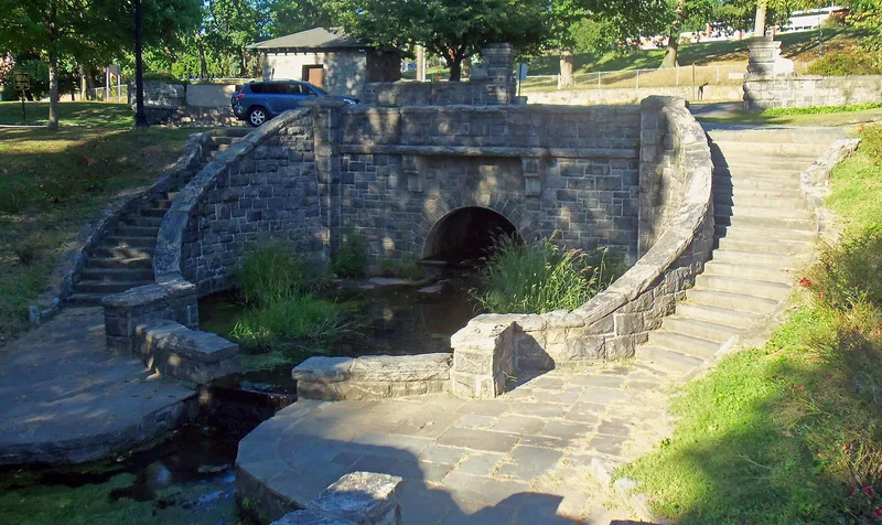
Patriots' Park is a four-acre public park on Route 9A, split by Andre Brook, which marks the boundary between Tarrytown and North Tarrytown. It commemorates the September 1780 capture of Major John Andre, a British officer disguised as a civilian and carrying Benedict Arnold's plans for betraying West Point. Three local men, John Paulding, Isaac Van Wart and David Williams, stopped him about two hundred yards east of the site. A monument to them was first dedicated in 1853 on land donated by free Black property owners, and it was redesigned in 1880 with a bronze statue of Paulding. In 1892 the site became Brookside Park, a residential development laid out by Carrere and Hastings. The houses are gone, but the gatehouse, gateposts, stone walls, oval drive, basin and arched bridges remain. Later given to the two villages, the park is used for recreation and sits beside a civic center.
Significance in brief: The park is tied to the 1780 capture of British Major John Andre, who carried Benedict Arnold's West Point plans, by three Westchester men. Its monument, first dedicated in 1853, is one of the earliest memorials to an American Revolution event. The park also keeps the gatehouse, oval drive and water-axis treatment from the 1892 Beaux-Arts plan by Carrere and Hastings.
Machine-generated summary. This summary was generated by a language model from the official nomination document and has not been reviewed line by line by an editor. It may contain errors. Check the source document before relying on any detail. Source: nomination document (PDF) · National Archives catalog entry. NRHP reference 82003415, listed June 14, 1982. Summary generated October 2026 (model claude-sonnet-5-5, prompt v1.0-2026-10-29, confidence high).
Key facts
| Address | US 9, Tarrytown |
|---|---|
| County | Westchester County |
| Listed | June 14, 1982 |
| Reference number | 82003415 |
| Resource type | Site |
| Architect / builder | Carrere and Hastings |
| Architectural style | Beaux-Arts |
| Areas of significance | Landscape Architecture, Military |
| Level of significance | Local |
| Status (as stated in the nomination) | Public park in good condition, used for active and passive recreation. It has been altered: the Brookside Park houses were razed and the brook channel was concreted. |
| Acreage | 4 |
| Coordinates | 41.08166, -73.85912 (NPS GIS) |
What listing means for this property
Sites (archaeological sites, battlefields, landscapes) are often listed with a restricted address to protect them from looting or disturbance. Listing is honorary for private owners; federal undertakings on or near the site go through Section 106 review, and state laws may protect burials and artefacts regardless of listing.
General information, not legal or tax advice. Rules change; confirm with your State Historic Preservation Office or a qualified adviser.
Sources and further reading
- National Park Service, National Register of Historic Places database (snapshot May 2026), reference 82003415.
- Nomination form (PDF, National Archives) — catalog entry
- Wikipedia article (used for cross-checking only; text not reproduced here)
- Wikidata Q7147976
- This listing as JSON
Last updated October 2026. Found an error? See the editorial policy for how to report it.