Kingston-Port Ewen Suspension Bridge

Why it's listed
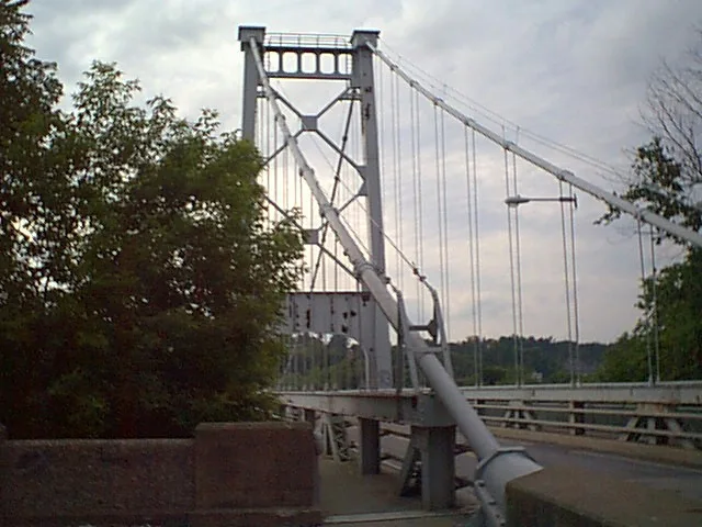
Carrying U.S. Route 9W over Rondout Creek, this suspension bridge links Port Ewen on the south with the city of Kingston on the north. Riveted steel towers rise 153 feet on concrete piers and support cables across a 1,145-foot span, with a reinforced concrete deck about 86 feet above the water. Local frustration with unreliable chain ferry service in the nineteenth century prompted the idea of a crossing, and in 1916 New York State committed to building it as part of a highway system designed for automobiles. Heavy commercial shipping on the creek led planners to choose a clear span rather than a design with a midstream pier. Terry & Tench Co. received the contract in 1920, and the steel work was finished in November 1921. The bridge opened in May 1922. It completed the first north-south automobile highway along the Hudson's West Shore and remains a visual landmark and a busy route into Kingston.
Significance in brief: The bridge completed New York's first north-south automobile highway along the Hudson's West Shore and is presented as an important engineering achievement of early motoring. It showed the leading technological and design features of its time. It has also become a prominent visual landmark of the Rondout Creek setting.
Machine-generated summary. This summary was generated by a language model from the official nomination document and has not been reviewed line by line by an editor. It may contain errors. Check the source document before relying on any detail. Source: nomination document (PDF) · National Archives catalog entry. NRHP reference 80002783, listed April 30, 1980. Summary generated October 2026 (model claude-sonnet-5-5, prompt v1.0-2026-10-29, confidence high).
Key facts
| Address | U.S. 9W, Kingston and |
|---|---|
| County | Ulster County |
| Listed | April 30, 1980 |
| Reference number | 80002783 |
| Resource type | Structure |
| Period of significance | 1900- (specific date 1921) |
| Architect / builder | Terry & Tench Co. |
| Areas of significance | Engineering, Transportation |
| Level of significance | Local |
| Status (as stated in the nomination) | Condition listed as excellent and unaltered; the bridge continues to carry a heavy volume of daily traffic. |
| Acreage | 0.9 |
| Within district | Rondout-West Strand Historic District |
| Coordinates | 41.91732, -73.98508 (NPS GIS) |
What listing means for this property
For a publicly owned building or structure, listing mainly matters when federal funds, permits or licences are involved: projects then go through Section 106 review so effects on the property are considered. Listing also strengthens applications for preservation grants and, for leased income-producing uses, can enable the federal rehabilitation tax credit.
General information, not legal or tax advice. Rules change; confirm with your State Historic Preservation Office or a qualified adviser.
Sources and further reading
- National Park Service, National Register of Historic Places database (snapshot May 2026), reference 80002783.
- Nomination form (PDF, National Archives) — catalog entry
- Wikipedia article (used for cross-checking only; text not reproduced here)
- Wikidata Q6413678
- This listing as JSON
Last updated October 2026. Found an error? See the editorial policy for how to report it.