Park Place Historic District

Why it's listed
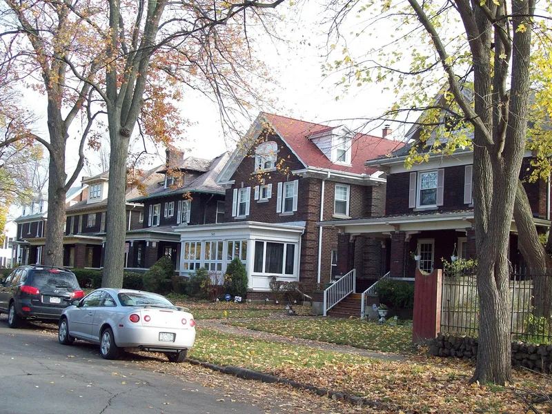
Park Place Historic District is a triangular residential neighborhood on the west side of Main Street in downtown Niagara Falls, New York. It includes Park Place, the 600 and 700 blocks of 4th Street, and parts of Pine Avenue and Main Street. Eighty-nine contributing buildings, mostly houses built between 1885 and 1928, stand alongside Wright Park, which holds veterans' memorials and a cenotaph obelisk, and a restored stone fence from the former Schoellkopf estate. The land was sold to Jacob Schoellkopf, whose hydraulic power company helped develop the area. Small lots on the 600 block of 4th Street held worker housing and travelers' homes. Larger lots on Park Place and the 700 block, protected by deed restrictions, held homes of the power company's executives and other industrial leaders. The houses show Queen Anne, Italianate, Arts and Crafts, Colonial Revival and Tudor Revival styles. Tree-lined streets and alley-served lots have kept the neighborhood's early residential character, unlike many nearby downtown areas that lost buildings to demolition.
Significance in brief: The nomination presents the district as a well-preserved neighborhood tied to the city's power industry. Smaller 600-block lots housed workers and travelers, while larger Park Place and 700-block lots housed industrial executives, so the layout reflects class differences. The homes show Queen Anne, Italianate, Arts and Crafts, Colonial Revival and Tudor Revival styles.
Machine-generated summary. This summary was generated by a language model from the official nomination document and has not been reviewed line by line by an editor. It may contain errors. Check the source document before relying on any detail. Source: nomination document (PDF) · National Archives catalog entry. NRHP reference 10000809, listed October 1, 2010. Summary generated October 2026 (model claude-sonnet-5-5, prompt v1.0-2026-10-29, confidence medium).
Key facts
| Address | Park Pl, portions of Prince Ave, 4th St, and Main St, Niagara Falls |
|---|---|
| County | Niagara County |
| Listed | October 1, 2010 |
| Reference number | 10000809 |
| Resource type | District |
| Architectural style | Late Victorian (Italianate, Queen Anne); Late 19th & 20th Century Colonial Revival and Craftsman |
| Areas of significance | Architecture |
| Level of significance | Local |
| Status (as stated in the nomination) | Most of the district remains residential with high architectural integrity. A few homes have been adapted for office use, and a former gas station serves as a tourist center. |
| Acreage | 17.1 |
| Coordinates | 43.09582, -79.05824 (NPS GIS) |
What listing means for this property
This is a historic district. Buildings within its boundary are either contributing (they add to the district's significance) or non-contributing. Owners of contributing income-producing buildings can claim the 20% federal rehabilitation tax credit; homeowners should look at state credits. National Register districts impose no design review by themselves; a local historic district ordinance, if one exists, does (the difference explained).
General information, not legal or tax advice. Rules change; confirm with your State Historic Preservation Office or a qualified adviser.
Sources and further reading
- National Park Service, National Register of Historic Places database (snapshot May 2026), reference 10000809.
- Nomination form (PDF, National Archives) — catalog entry
- Wikipedia article (used for cross-checking only; text not reproduced here)
- Wikidata Q7137931
- This listing as JSON
Last updated October 2026. Found an error? See the editorial policy for how to report it.