Chambers Street Subway Station (Dual System BMT)

Why it's listed
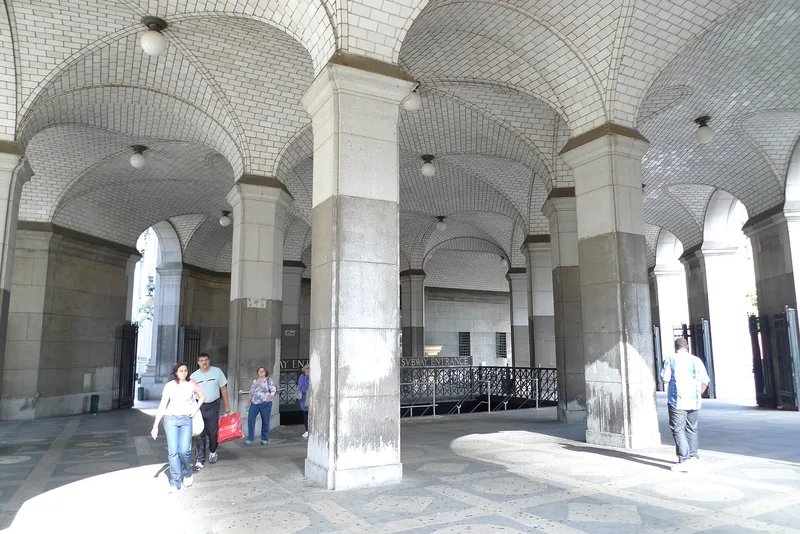
Beneath the Municipal Building in Lower Manhattan lies a four-track subway station that was planned in 1907 by the architects Heins & LaFarge, built from 1911 and opened in 1913 as part of the BMT Dual System. Built by the cut-and-cover method on two levels, platform and mezzanine, it served the civic center of City Hall and nearby courthouses and connects to the IRT Brooklyn Bridge station. Its original layout of four tracks and five platforms was unusual, though most platforms are now closed. The station is valued for its transportation role and for surviving decoration, including ceramic plaques showing the Brooklyn Bridge, mosaic friezes, faience name tablets, pink marble wainscoting, and bronze entrance railings and signs designed to harmonize with the Municipal Building. It has been altered repeatedly since 1914 and suffers serious water damage, but it keeps a fairly high degree of integrity.
Significance in brief: The nomination argues the station is significant locally under Criterion A for transportation, community planning and social history, and under Criterion C for engineering, architecture and art. It was a major node serving the civic center and retains original decorative elements, notably ceramic Brooklyn Bridge plaques and south entrance railings and signs designed to harmonize with the Municipal Building.
Machine-generated summary. This summary was generated by a language model from the official nomination document and has not been reviewed line by line by an editor. It may contain errors. Check the source document before relying on any detail. Source: nomination document (PDF) · National Archives catalog entry. NRHP reference 05000669, listed July 6, 2005. Summary generated October 2026 (model claude-sonnet-5-5, prompt v1.0-2026-10-29, confidence high).
Key facts
| Address | Beneath the Municipal Building at Chambers, Centre and Duane Sts. and Lafayette Plaza, New York |
|---|---|
| County | Manhattan |
| Listed | July 6, 2005 |
| Reference number | 05000669 |
| Resource type | Structure |
| Period of significance | 1911-1913 |
| Architect / builder | Heins & LaFarge (architects) |
| Architectural style | Late 19th & 20th Century Revivals/Beaux-Arts |
| Criteria |
|
| Areas of significance | Transportation, Architecture, Art, Engineering, Community Planning and Development, Social History |
| Level of significance | Local |
| Status (as stated in the nomination) | Described as in poor condition and in need of restoration, with significant water damage; most platforms are closed and many original entrances blocked. The station remains in transit use. |
| Acreage | 0.9 |
| Coordinates | 40.71325, -74.00359 (NPS GIS) |
What listing means for this property
For an income-producing building, listing (individually or as a contributing building in a district) is the gateway to the 20% federal rehabilitation tax credit on qualified rehabilitation costs, often stackable with state credits. Work claiming the credit must follow the Secretary of the Interior's Standards and be approved in advance.
Listing does not restrict a private owner acting without federal money or permits; where federal funding or licensing is involved, Section 106 review applies.
General information, not legal or tax advice. Rules change; confirm with your State Historic Preservation Office or a qualified adviser.
Sources and further reading
- National Park Service, National Register of Historic Places database (snapshot May 2026), reference 05000669.
- Nomination form (PDF, National Archives) — catalog entry
- Wikipedia article (used for cross-checking only; text not reproduced here)
- Wikidata Q2612593
- This listing as JSON
Last updated October 2026. Found an error? See the editorial policy for how to report it.