South Ann Street-Mill Street Historic District

Why it's listed
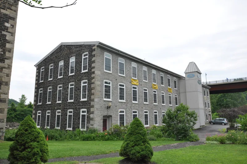
Along the north bank of the Mohawk River in Little Falls, this small district preserves part of the city's canal-era industrial core. Its 16 contributing features include a four-story stone woolen mill built in 1839, a second stone mill of 1855, a brick factory and frame carriage works, and a 1911 stone and brick hydroelectric station beside the remains of a dam. Commercial buildings include a rare connected row of brick Greek Revival stores from about 1835 and two brick blocks on Mohawk Street. Transportation is represented by the ruins of the Erie Canal aqueduct and basin, a steel bridge and the 1894 railroad passenger station. Water power from the falls and access to the Erie Canal, opened through Little Falls in 1825, drew mills, knitting works and a large shoe factory to the area. Fire, flood and demolition removed many buildings, but the survivors show how the canal and river shaped local industry and commerce between about 1827 and 1911.
Significance in brief: The district is significant under Criteria A and C as a largely intact grouping of industrial and commercial architecture tied to the Erie Canal and the Mohawk River's water power. It includes the 1839 stone woolen mill, the 1855 stone mill, a rare row of canal-era brick Greek Revival stores, canal aqueduct remains, a railroad station and a 1911 hydroelectric plant.
Machine-generated summary. This summary was generated by a language model from the official nomination document and has not been reviewed line by line by an editor. It may contain errors. Check the source document before relying on any detail. Source: nomination document (PDF) · National Archives catalog entry. NRHP reference 08000139, listed March 6, 2008. Summary generated October 2026 (model claude-sonnet-5-5, prompt v1.0-2026-10-29, confidence high).
Key facts
| Address | S. Ann & Mill Sts., Little Falls |
|---|---|
| County | Herkimer County |
| Listed | March 6, 2008 |
| Reference number | 08000139 |
| Resource type | District |
| Period of significance | 1827-1911 |
| Architectural style | No style |
| Criteria |
|
| Areas of significance | Commerce, Industry, Engineering, Architecture |
| Level of significance | Local |
| Status (as stated in the nomination) | Several parcels are vacant after fires and demolition. Some buildings have been reused, including the former railroad station as a restaurant, an 1855 mill as an antique center with apartments, and the powerhouse as a residence and studio. The aqueduct is in ruins. |
| Acreage | 5 |
| Coordinates | 43.04267, -74.85783 (NPS GIS) |
What listing means for this property
This is a historic district. Buildings within its boundary are either contributing (they add to the district's significance) or non-contributing. Owners of contributing income-producing buildings can claim the 20% federal rehabilitation tax credit; homeowners should look at state credits. National Register districts impose no design review by themselves; a local historic district ordinance, if one exists, does (the difference explained).
General information, not legal or tax advice. Rules change; confirm with your State Historic Preservation Office or a qualified adviser.
Sources and further reading
- National Park Service, National Register of Historic Places database (snapshot May 2026), reference 08000139.
- Nomination form (PDF, National Archives) — catalog entry
- Wikipedia article (used for cross-checking only; text not reproduced here)
- Wikidata Q7565991
- This listing as JSON
Last updated October 2026. Found an error? See the editorial policy for how to report it.