Fort Independence
Also known as: The Castle; Castle William; Castle William & Mary; Fort Mary

Why it's listed
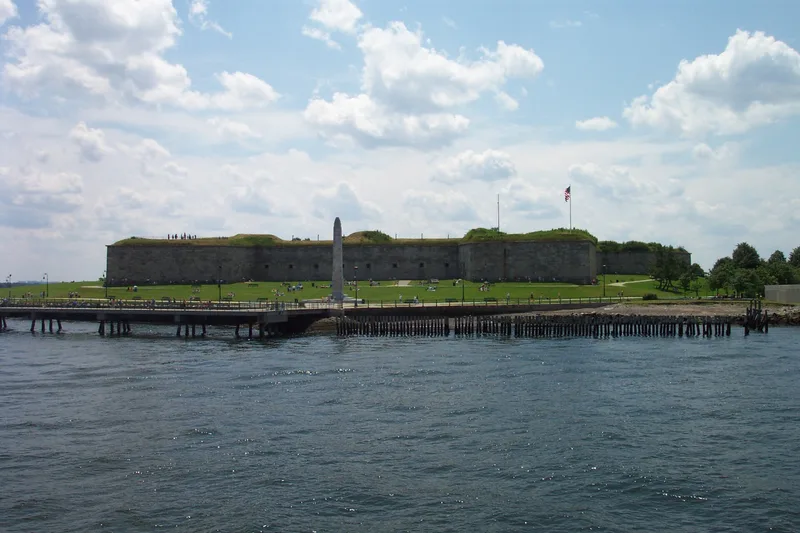
Fort Independence occupies Castle Island at the edge of South Boston and guards the main ship channel into Boston Harbor. Fortifications began there in 1634 under John Winthrop, with wooden batteries followed by a castle that burned in 1673. A stone Fort William was completed in 1705 and was regarded as the most impressive fort in British North America. It was renamed Fort Independence in 1798 after Massachusetts ceded it to the United States. John Foncin designed a new five-bastion fort, finished by 1809. Rebuilding began in the 1830s and the brick and granite pentagon was garrisoned again by 1851. The island saw colonial unrest, including the imprisonment of Governor Andros in 1689 and the quartering of British troops after the Boston Massacre, and later Civil War volunteer units. Military use ended in 1962, when the fort returned to the Commonwealth as a historic monument.
Significance in brief: Castle Island is described as the oldest fortified site in the original Massachusetts Bay Colony, apart from an earlier defense on Fort Hill. It guarded the main ship channel into Boston Harbor and figured in colonial and Revolutionary events such as the 1689 imprisonment of Governor Andros and the quartering of British troops after the Boston Massacre. Its military history lasted 328 years, ending in 1962.
Machine-generated summary. This summary was generated by a language model from the official nomination document and has not been reviewed line by line by an editor. It may contain errors. Check the source document before relying on any detail. Source: nomination document (PDF) · National Archives catalog entry. NRHP reference 70000921, listed October 15, 1970. Summary generated October 2026 (model claude-sonnet-5-5, prompt v1.0-2026-10-29, confidence medium).
Key facts
| Address | Castle Island, Boston |
|---|---|
| County | Suffolk County |
| Listed | October 15, 1970 |
| Reference number | 70000921 |
| Resource type | Site |
| Architect / builder | John Foncin (designer of the early 19th century fort); Colonel William Wolfgang Romer and Capt. John Redknap (Fort William, 1705) |
| Areas of significance | Military |
| Level of significance | National |
| Status (as stated in the nomination) | Owned by the Commonwealth of Massachusetts (Metropolitan District Commission), used as a park and historic monument; condition marked as altered and fair. |
| Acreage | 15 |
| Coordinates | 42.33815, -71.01117 (NPS GIS) |
What listing means for this property
Sites (archaeological sites, battlefields, landscapes) are often listed with a restricted address to protect them from looting or disturbance. Listing is honorary for private owners; federal undertakings on or near the site go through Section 106 review, and state laws may protect burials and artefacts regardless of listing.
General information, not legal or tax advice. Rules change; confirm with your State Historic Preservation Office or a qualified adviser.
Sources and further reading
- National Park Service, National Register of Historic Places database (snapshot May 2026), reference 70000921.
- Nomination form (PDF, National Archives) — catalog entry
- Wikipedia article (used for cross-checking only; text not reproduced here)
- Wikidata Q1438579
- This listing as JSON
Last updated October 2026. Found an error? See the editorial policy for how to report it.