Dorchester Heights National Historic Site
Also known as: Dorchester Heights

Why it's listed
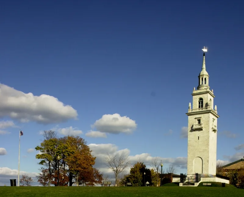
Dorchester Heights is a hilltop park in South Boston crowned by a tower of about 100 feet, faced in white marble over brick and stone. Peabody and Stearns won an 1898 competition to design it, and it was completed in 1901 in the Georgian Colonial Revival style, inspired by 18th-century church towers. The hill is where General Washington's army fortified the heights on the night of March 4, 1776, placing cannon brought from Fort Ticonderoga above the city. Faced with this position, British General William Howe withdrew his army from Boston on March 17. The tower marks the site of those fortifications and is also valued as a work by Robert Swain Peabody and John G. Stearns, pioneers of the style. The surrounding Thomas Park, laid out in the mid-nineteenth century after the hill was cut down for a reservoir, was the first land in South Boston set aside by the city for public use. Its walks still reflect the original Victorian layout.
Significance in brief: The site commemorates General Washington's fortification of the hill in March 1776, which forced the British to evacuate Boston and was the first great American victory of the Revolution. The monument is also significant as an example of Georgian Colonial Revival architecture by Peabody and Stearns. Thomas Park is notable as the first parcel of land in South Boston set aside by the city for public purposes.
Machine-generated summary. This summary was generated by a language model from the official nomination document and has not been reviewed line by line by an editor. It may contain errors. Check the source document before relying on any detail. Source: nomination document (PDF) · National Archives catalog entry. NRHP reference 66000050, listed October 15, 1966. Summary generated October 2026 (model claude-sonnet-5-5, prompt v1.0-2026-10-29, confidence high).
Key facts
| Address | South Boston, Boston |
|---|---|
| County | Suffolk County |
| Listed | October 15, 1966 |
| Reference number | 66000050 |
| Resource type | Structure |
| Period of significance | 1776, 1901 |
| Architect / builder | Peabody and Stearns |
| Architectural style | Georgian Colonial Revival |
| Areas of significance | Community Planning and Development, Military, Architecture |
| Level of significance | National |
| Status (as stated in the nomination) | Marked unoccupied on the form; condition is altered, and the park is on its original site. Tie rods and concrete members were added to arrest movement and cracking in the upper tower. |
| Acreage | 5.4 |
| Within district | Boston National Historical Park |
| Coordinates | 42.33279, -71.04577 (NPS GIS) |
What listing means for this property
National Register listing is honorary: it recognises significance and does not restrict what a private owner may do without federal money or permits. It unlocks the 20% federal rehabilitation tax credit for income-producing buildings, state credits in many states, and Section 106 review when federal agencies are involved. See what listing means in practice.
General information, not legal or tax advice. Rules change; confirm with your State Historic Preservation Office or a qualified adviser.
Sources and further reading
- National Park Service, National Register of Historic Places database (snapshot May 2026), reference 66000050.
- Nomination form (PDF, National Archives) — catalog entry
- Wikipedia article (used for cross-checking only; text not reproduced here)
- Wikidata Q5297608
- This listing as JSON
Last updated October 2026. Found an error? See the editorial policy for how to report it.