First Burial Ground
Also known as: Park Street Burial Ground

Why it's listed
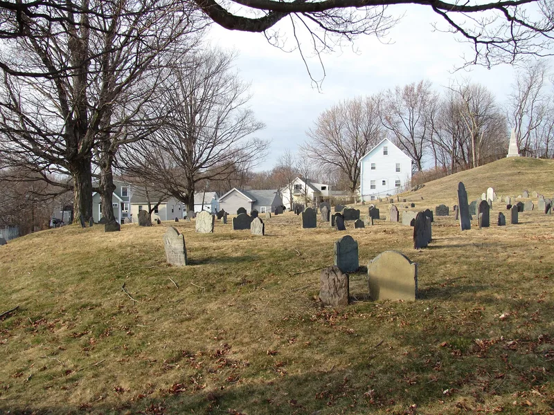
Woburn's First Burial Ground occupies 1.4 acres on a steep slope at Park and Centre Streets, just north of the city common. Established around 1646, shortly after the town center was laid out, it served as the community's main graveyard until 1794. Burials continued occasionally, with the last in 1903. Today about 203 gravestones remain, mostly slate stones dated 1690 to 1794 and carved with winged death's heads. Many show the style of Joseph Lamson and the Lamson family of carvers from Charlestown and Malden. Those buried here include Captain Edward Johnson, an early Woburn founder and author of an early history of New England, and fifteen Revolutionary War soldiers, among them two killed at Lexington and Concord. The largest monument marks the Baldwin family tomb, which includes Col. Loammi Baldwin and his civil engineer son. The grounds may also contain unmarked graves and other buried evidence of earlier use, including a former town pound.
Significance in brief: It is the oldest burial place in Woburn and was the town's only municipal burying ground for its first 160 years, holding the graves of founders and Revolutionary War soldiers. It also preserves an excellent collection of 17th and 18th century slate gravestones, many carved by the Lamson family of stone carvers. It may also hold archaeological evidence of unmarked graves.
Machine-generated summary. This summary was generated by a language model from the official nomination document and has not been reviewed line by line by an editor. It may contain errors. Check the source document before relying on any detail. Source: nomination document (PDF) · National Archives catalog entry. NRHP reference 04001222, listed November 13, 2004. Summary generated October 2026 (model claude-sonnet-5-5, prompt v1.0-2026-10-29, confidence high).
Key facts
| Address | Park St. near Centre St., Woburn |
|---|---|
| County | Middlesex County |
| Listed | November 13, 2004 |
| Reference number | 04001222 |
| Resource type | Site |
| Period of significance | 1646-1903 |
| Criteria |
|
| Areas of significance | Art, Community Planning and Development, Social History |
| Level of significance | Local |
| Status (as stated in the nomination) | Still a cemetery. It is city-owned, with chain link fencing, a fieldstone retaining wall and commemorative plaques near the entrance. |
| Acreage | 1.4 |
| Coordinates | 42.48168, -71.15269 (NPS GIS) |
What listing means for this property
Sites (archaeological sites, battlefields, landscapes) are often listed with a restricted address to protect them from looting or disturbance. Listing is honorary for private owners; federal undertakings on or near the site go through Section 106 review, and state laws may protect burials and artefacts regardless of listing.
General information, not legal or tax advice. Rules change; confirm with your State Historic Preservation Office or a qualified adviser.
Sources and further reading
- National Park Service, National Register of Historic Places database (snapshot May 2026), reference 04001222.
- Nomination form (PDF, National Archives) — catalog entry
- Wikipedia article (used for cross-checking only; text not reproduced here)
- Wikidata Q5452575
- This listing as JSON
Last updated October 2026. Found an error? See the editorial policy for how to report it.