Davis, Isaac, Trail
Also known as: Acton's Trail

Why it's listed
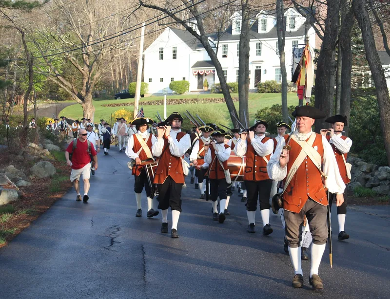
This six-mile route links Captain Isaac Davis' house in Acton with the Muster Field beside the Concord River. It runs along Hayward Street, Musket Drive, Minuteman Road, Woodbury Lane and Main Street, then over a cart path and town easement to Strawberry Hill Road, Barrett's Mill Road and Barnes Hill Road, ending near the Old North Bridge. Most of it is paved and owned by the towns of Acton and Concord, yet stone walls, woods and set-back houses keep the look of 1775. On April 19, 1775, Davis led the Acton Company along this path to join men from neighboring towns, and he fell at the head of the line at the bridge. The exact route was mapped in 1896 from the testimony of a veteran's son. Each Patriots' Day, thousands gather at Davis' house and walk the route at the hour Davis set out, re-enacting the march.
Significance in brief: The trail is the route taken by the Acton Company, led by Captain Isaac Davis, to the Muster Field, where the men advanced across the Old North Bridge at the start of the American Revolution. Davis was the first to fall in that action. The exact path was mapped in 1896 from testimony, and the march is re-enacted each Patriots' Day.
Machine-generated summary. This summary was generated by a language model from the official nomination document and has not been reviewed line by line by an editor. It may contain errors. Check the source document before relying on any detail. Source: nomination document (PDF) · National Archives catalog entry. NRHP reference 72001347, listed April 11, 1972. Summary generated October 2026 (model claude-sonnet-5-5, prompt v1.0-2026-10-29, confidence medium).
Key facts
| Address | Running E-W between towns of Acton and Concord, Acton |
|---|---|
| County | Middlesex County |
| Listed | April 11, 1972 |
| Reference number | 72001347 |
| Resource type | Structure |
| Period of significance | April 19, 1775 (18th Century) |
| Areas of significance | Military, Transportation, Social History |
| Level of significance | National, State, Local |
| Status (as stated in the nomination) | Condition listed as good and altered; the route is mostly tarred roads owned by the Towns of Acton and Concord, plus two easements, and is still used for annual re-enactments. |
| Acreage | 10.4 |
| Coordinates | 42.48040, -71.39836 (NPS GIS) |
What listing means for this property
National Register listing is honorary: it recognises significance and does not restrict what a private owner may do without federal money or permits. It unlocks the 20% federal rehabilitation tax credit for income-producing buildings, state credits in many states, and Section 106 review when federal agencies are involved. See what listing means in practice.
General information, not legal or tax advice. Rules change; confirm with your State Historic Preservation Office or a qualified adviser.
Sources and further reading
- National Park Service, National Register of Historic Places database (snapshot May 2026), reference 72001347.
- Nomination form (PDF, National Archives) — catalog entry
- Wikipedia article (used for cross-checking only; text not reproduced here)
- Wikidata Q6076232
- This listing as JSON
Last updated October 2026. Found an error? See the editorial policy for how to report it.