1767 Milestones

Why it's listed
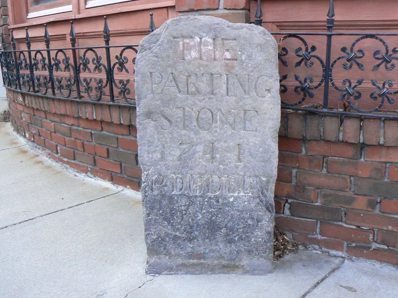
Forty milestones set in 1767 survive along the Old Post Road between Boston and Springfield, out of an original ninety-nine. They mark mile intervals and are round-headed or rectangular monoliths, granite in the east and gray or brown sandstone in Worcester and Hampden Counties. Most carry a short inscription giving the number of miles from Boston. The best known is the Roxbury Parting Stone, erected by Paul Dudley and dated 1744, which gives directions to Dedham, Rhode Island, Cambridge and Watertown. The stones came about after Britain directed its colonies to survey their post roads; in 1767 the Massachusetts Council advised that stones be fixed at the mile marks of Captain Miller's survey, sometimes reusing stones set earlier by Dudley. The Works Progress Administration described them in 1940, and an Act of 1960 directed the Department of Public Works to preserve them. Most stones are in good condition, though some have been moved, broken or worn.
Significance in brief: The milestones mark an important step in the history of American transportation. They resulted from British executive and parliamentary direction that the colonies survey their post roads, which Massachusetts carried out in the 1760s. The stones were later documented in a 1941 publication and a 1960 state law directed their preservation.
Machine-generated summary. This summary was generated by a language model from the official nomination document and has not been reviewed line by line by an editor. It may contain errors. Check the source document before relying on any detail. Source: nomination document (PDF) · National Archives catalog entry. NRHP reference 71000084, listed April 7, 1971. Summary generated October 2026 (model claude-sonnet-5-5, prompt v1.0-2026-10-29, confidence medium).
Key facts
| Address | Between Boston and Springfield along Old Post Rd., Springfield |
|---|---|
| County | Hampden County |
| Listed | April 7, 1971 |
| Reference number | 71000084 |
| Resource type | District |
| Period of significance | 1767 |
| Areas of significance | Transportation |
| Level of significance | State |
| Status (as stated in the nomination) | Condition is generally good; nearly all stones keep their original shapes, though some are fragments or broken, four are illegible, and many have been moved short distances from the road. The state Department of Public Works is directed to preserve them. |
| Within district | Roxbury Highlands Historic District |
| Coordinates | 42.33010, -71.09089 (NPS GIS) |
What listing means for this property
This is a historic district. Buildings within its boundary are either contributing (they add to the district's significance) or non-contributing. Owners of contributing income-producing buildings can claim the 20% federal rehabilitation tax credit; homeowners should look at state credits. National Register districts impose no design review by themselves; a local historic district ordinance, if one exists, does (the difference explained).
General information, not legal or tax advice. Rules change; confirm with your State Historic Preservation Office or a qualified adviser.
Sources and further reading
- National Park Service, National Register of Historic Places database (snapshot May 2026), reference 71000084.
- Nomination form (PDF, National Archives) — catalog entry
- Wikipedia article (used for cross-checking only; text not reproduced here)
- Wikidata Q4553039
- This listing as JSON
Last updated October 2026. Found an error? See the editorial policy for how to report it.