East Main Street Cemetery

Why it's listed
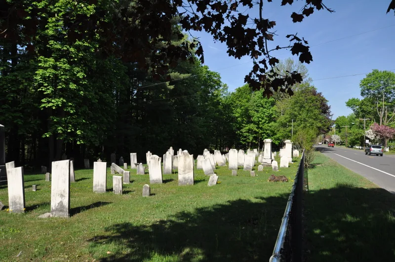
East Main Street Cemetery is a two-acre graveyard on the north side of East Main Street (Route 8) in Dalton, Massachusetts. The Chamberlin family set it aside for burying relatives and neighbors, and about one-fifth of the stones honor family members. Roughly 255 markers or fragments remain, dated 1781 to 1895, set in twenty-four irregular rows. Most are pale gray marble tablets, some carved with winged soul-effigies, urns and willows, draperies, or open books. Five larger monuments include two pedestal memorials flanking the central gate. The grounds have no formal paths, only grassy aisles, and burials ended in the 1890s. Neglect and vandalism led to repairs and new fencing in 1892, 1930, 1962 and 1985, and to resetting of stones in the 1970s. The plot reflects early settlement practice, shows changing attitudes toward death in its carving, and records family losses, especially among children. It is also considered likely to hold archaeological evidence of unmarked graves and earlier boundary walls and fences.
Significance in brief: The cemetery is a typical example of a small eighteenth-century family or neighborhood burial ground, laid out in simple rows rather than by landscape design. Its marble markers show changing gravestone carving motifs and record the families and hardships of early Dalton. The form also cites high archaeological potential for historic resources and possible unmarked graves.
Machine-generated summary. This summary was generated by a language model from the official nomination document and has not been reviewed line by line by an editor. It may contain errors. Check the source document before relying on any detail. Source: nomination document (PDF) · National Archives catalog entry. NRHP reference 00000567, listed June 2, 2000. Summary generated October 2026 (model claude-sonnet-5-5, prompt v1.0-2026-10-29, confidence medium).
Key facts
| Address | E. Main St., Dalton |
|---|---|
| County | Berkshire County |
| Listed | June 2, 2000 |
| Reference number | 00000567 |
| Resource type | Site |
| Areas of significance | Art, Landscape Architecture, Social History |
| Level of significance | Local |
| Status (as stated in the nomination) | Described as well maintained today, though vandalism, weather, settling and breakage have damaged many stones; no new burials since the 1890s. |
| Acreage | 2 |
| Coordinates | 42.47340, -73.15102 (NPS GIS) |
What listing means for this property
Sites (archaeological sites, battlefields, landscapes) are often listed with a restricted address to protect them from looting or disturbance. Listing is honorary for private owners; federal undertakings on or near the site go through Section 106 review, and state laws may protect burials and artefacts regardless of listing.
General information, not legal or tax advice. Rules change; confirm with your State Historic Preservation Office or a qualified adviser.
Sources and further reading
- National Park Service, National Register of Historic Places database (snapshot May 2026), reference 00000567.
- Nomination form (PDF, National Archives) — catalog entry
- Wikipedia article (used for cross-checking only; text not reproduced here)
- Wikidata Q5328915
- This listing as JSON
Last updated October 2026. Found an error? See the editorial policy for how to report it.