Brewster Old King's Highway Historic District

Why it's listed
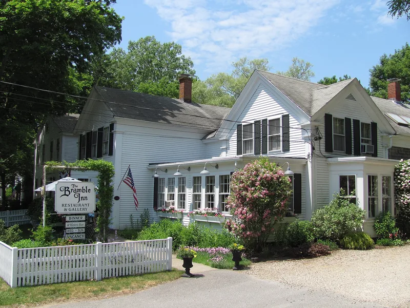
Strung along the old King's Highway, now Main Street, this Brewster district follows a route laid out in 1665 as Cape Cod's main overland road. At its center stand the First Parish Church, rebuilt in 1834 on its 1700 site, and the Old Burying Ground of 1707. Around them are Cape cottages, two-story captains' mansions, barns, stone walls and cemeteries, set among salt marshes, fields and woodland. Most of the contributing buildings date from the late 18th to mid-19th century, when Brewster mariners commanded packets and merchant ships and brought home considerable wealth. More than a hundred sea captains lived in the town during the 19th century, and many built the houses and institutions that remain. Civic landmarks include the Queen Anne Old Town Hall of 1881 and the Stick Style Ladies Library of 1868, the first library building on Cape Cod. Together the resources illustrate settlement patterns, maritime prosperity and changing architectural taste from about 1650 to 1945.
Significance in brief: The district is presented as a well-preserved record of Brewster's settlement, its prosperity as home to many sea captains, and its architectural development from the early 18th century onward. Its dwellings and institutional buildings, especially from the first half of the 19th century, reflect the wealth of the maritime trade and packet service. The road itself was laid out in 1665 as the region's main overland route.
Machine-generated summary. This summary was generated by a language model from the official nomination document and has not been reviewed line by line by an editor. It may contain errors. Check the source document before relying on any detail. Source: nomination document (PDF) · National Archives catalog entry. NRHP reference 96000162, listed February 23, 1996. Summary generated October 2026 (model claude-sonnet-5-5, prompt v1.0-2026-10-29, confidence medium).
Key facts
| Address | Roughly, MA 6A from E of Paines Creek Rd. to Bittersweet Dr. and parts of Briar and Lower Rds., Brewster |
|---|---|
| County | Barnstable County |
| Listed | February 23, 1996 |
| Reference number | 96000162 |
| Resource type | District |
| Period of significance | ca. 1650-1945 |
| Architect / builder | Whittemore Peterson (First Parish Church, 1834); Walter T. Winslow (Old Town Hall, 1881); Henry Boles (1976 library wing) |
| Architectural style | No style; Colonial: Georgian; Early Republic: Federal; Greek Revival; Gothic Revival; Italianate; Second Empire; Queen Anne; Stick Style; Colonial Revival; Craftsman |
| Areas of significance | Architecture, Commerce, Community Planning and Development, Maritime History, Politics/Government, Transportation |
| Level of significance | State |
| Status (as stated in the nomination) | Buildings remain in a mix of residential, commercial, civic, religious and library uses; many old barns are reused as antique shops and other businesses. |
| Acreage | 260 |
| Coordinates | 41.75773, -70.08923 (NPS GIS) |
What listing means for this property
This is a historic district. Buildings within its boundary are either contributing (they add to the district's significance) or non-contributing. Owners of contributing income-producing buildings can claim the 20% federal rehabilitation tax credit; homeowners should look at state credits. National Register districts impose no design review by themselves; a local historic district ordinance, if one exists, does (the difference explained).
General information, not legal or tax advice. Rules change; confirm with your State Historic Preservation Office or a qualified adviser.
Sources and further reading
- National Park Service, National Register of Historic Places database (snapshot May 2026), reference 96000162.
- Nomination form (PDF, National Archives) — catalog entry
- Wikipedia article (used for cross-checking only; text not reproduced here)
- Wikidata Q4962775
- This listing as JSON
Last updated October 2026. Found an error? See the editorial policy for how to report it.