Montgomery Ward Company Complex
Also known as: Montgomery Ward and Company Administration Building and Mail

Why it's listed
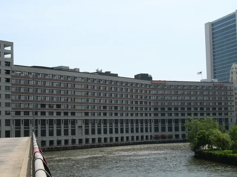
The Montgomery Ward Company Complex is a group of buildings in Chicago, Illinois, bounded by Kingsbury Street, Larrabee Street, West Chicago Avenue and the North Branch Canal and Chicago River. The surviving papers name two buildings within the boundary: the Catalog House at the northern end and the Administration Building at the southern end. The boundary runs roughly 1,100 feet along the east bank of the canal and river and about 825 feet along Larrabee Street. A corrected verbal boundary description was submitted by the Illinois state preservation office in 1985 and referred to the National Park Service history office, which administers the landmark program. The complex entered the national listing in 1978 as a result of its designation as a National Historic Landmark. The available pages contain no description of the architecture, builders, dates of construction or the specific reasons for landmark status.
Significance in brief: The supplied document contains only a corrected boundary description and administrative correspondence, not the significance statement. It does show that the complex was listed because it was designated a National Historic Landmark on June 2, 1978.
Machine-generated summary. This summary was generated by a language model from the official nomination document and has not been reviewed line by line by an editor. It may contain errors. Check the source document before relying on any detail. Source: nomination document (PDF) · National Archives catalog entry. NRHP reference 78001125, listed June 2, 1978. Summary generated October 2026 (model claude-sonnet-5-5, prompt v1.0-2026-10-29, confidence low).
Key facts
| Address | 619 W. Chicago Ave., Chicago |
|---|---|
| County | Cook County |
| Listed | June 2, 1978 |
| Reference number | 78001125 |
| Resource type | Building |
| Areas of significance | Commerce, Architecture |
| Level of significance | National |
| National Historic Landmark | Yes, designated June 2, 1978 |
| Acreage | 7 |
| Coordinates | 41.89724, -87.64367 (NPS GIS) |
What listing means for this property
For an income-producing building, listing (individually or as a contributing building in a district) is the gateway to the 20% federal rehabilitation tax credit on qualified rehabilitation costs, often stackable with state credits. Work claiming the credit must follow the Secretary of the Interior's Standards and be approved in advance.
Listing does not restrict a private owner acting without federal money or permits; where federal funding or licensing is involved, Section 106 review applies.
General information, not legal or tax advice. Rules change; confirm with your State Historic Preservation Office or a qualified adviser.
Sources and further reading
- National Park Service, National Register of Historic Places database (snapshot May 2026), reference 78001125.
- Nomination form (PDF, National Archives) — catalog entry
- Wikipedia article (used for cross-checking only; text not reproduced here)
- Wikidata Q6905828
- This listing as JSON
Last updated October 2026. Found an error? See the editorial policy for how to report it.