Bohemian National Cemetery

Why it's listed
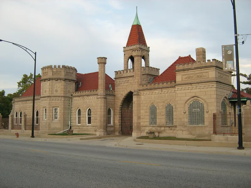
Bohemian National Cemetery occupies about 126 acres on Chicago's northwest side, entered through a medieval-revival limestone gatehouse on Pulaski Road. It was laid out in three stages: a grid plan by John V. Benes in 1878, a curving eastern and southern extension by August Petrtyl in 1903, and a northern section by Jens Jensen in 1906. The grounds hold 64 resources, including a gatehouse, administration building, domed Renaissance Revival crematorium and columbarium, a 1950 water tower group, and 48 private family mausoleums in varied revival styles. Six major public monuments mark the community's values, among them the Klacel bust, a Civil War soldier, the Mother Monument by Albin Polasek, and memorials to Spanish War, Odd Fellows and World War veterans. The cemetery was listed as the principal burial ground and gathering place of Chicago's Czech-American community, reflecting its ethnic heritage, patriotism, fraternal life and freethought traditions.
Significance in brief: The cemetery is presented as the central burial ground and civic gathering place of Chicago's Czech-American community. Its six public monuments express ethnic pride, immigrant patriotism, fraternal solidarity and freethought. Its landscape plans, buildings, mausoleums and sculpture, including work by Albin Polasek, add to its significance.
Machine-generated summary. This summary was generated by a language model from the official nomination document and has not been reviewed line by line by an editor. It may contain errors. Check the source document before relying on any detail. Source: nomination document (PDF) · National Archives catalog entry. NRHP reference 06000374, listed May 11, 2006. Summary generated October 2026 (model claude-sonnet-5-5, prompt v1.0-2026-10-29, confidence medium).
Key facts
| Address | Roughly bounded by Foster Ave., Pulaski Rd., Bryn Mawr Ave., and the approx. line of Central Park Ave., Chicago |
|---|---|
| County | Cook County |
| Listed | May 11, 2006 |
| Reference number | 06000374 |
| Resource type | District |
| Architect / builder | Landscape layouts by John V. Benes (1878), August Petrtyl (1903) and Jens Jensen (1906); monuments by Albin Polasek, Frantisek Hess, Theodora Ruggles Kitson and Gorham Manufacturing; World War I and II Memorial by Joseph R. Bednarik |
| Architectural style | Renaissance Revival, Classical Revival, Beaux Arts, Gothic Revival |
| Areas of significance | Ethnic Heritage, Architecture, Art, Landscape Architecture |
| Level of significance | National |
| Status (as stated in the nomination) | Still in use as a cemetery and mortuary; the administration building interior has been altered, and a 1949 warehouse was razed in 2005 after a strip of land was sold to the city. |
| Acreage | 126 |
| Coordinates | 41.98030, -87.72409 (NPS GIS) |
What listing means for this property
This is a historic district. Buildings within its boundary are either contributing (they add to the district's significance) or non-contributing. Owners of contributing income-producing buildings can claim the 20% federal rehabilitation tax credit; homeowners should look at state credits. National Register districts impose no design review by themselves; a local historic district ordinance, if one exists, does (the difference explained).
General information, not legal or tax advice. Rules change; confirm with your State Historic Preservation Office or a qualified adviser.
Sources and further reading
- National Park Service, National Register of Historic Places database (snapshot May 2026), reference 06000374.
- Nomination form (PDF, National Archives) — catalog entry
- Wikipedia article (used for cross-checking only; text not reproduced here)
- Wikidata Q890781
- This listing as JSON
Last updated October 2026. Found an error? See the editorial policy for how to report it.