Ravenswood Manor Historic District

Why it's listed
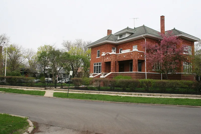
Ravenswood Manor is a triangular residential district on Chicago's northwest side, bounded by the North Branch of the Chicago River, Sacramento Avenue, and alleys near Lawrence and Montrose Avenues. It was platted in 1909 by New York developer William E. Harmon, who promoted it as a "Suburb Beautiful" in the spirit of the City Beautiful movement. Deed restrictions governed setbacks, garage placement and building character, and an improvement fund maintained trees and lawns until a neighborhood improvement association formed in 1914. Of 520 buildings, 475 contribute to the district, and about 94 percent were built between 1909 and 1933. Brick bungalows, American Foursquares and two-flats dominate, alongside Craftsman, Prairie, Tudor Revival and Italian Renaissance Revival houses. Rail service, including the 1907 Francisco Station on the line now called the Brown Line, drove its growth. Dead-end streets, private docks on the river, three small parks and mature trees give the area a quiet, cohesive character.
Significance in brief: The district is argued to represent early 20th-century residential neighborhood development and architectural trends in Chicago. It was a planned City Beautiful-influenced subdivision with deed restrictions, an improvement fund and a neighborhood improvement association. Rail service to Francisco Station spurred its growth, and it contains typical Chicago Bungalows, American Foursquares and revival-style houses.
Machine-generated summary. This summary was generated by a language model from the official nomination document and has not been reviewed line by line by an editor. It may contain errors. Check the source document before relying on any detail. Source: nomination document (PDF) · National Archives catalog entry. NRHP reference 08000836, listed September 5, 2008. Summary generated October 2026 (model claude-sonnet-5-5, prompt v1.0-2026-10-29, confidence medium).
Key facts
| Address | Between Sacramento Ave., N. branch of the Chicago river, and alleys S. of Lawrence Ave. and N. of Montrose Ave., Chicago |
|---|---|
| County | Cook County |
| Listed | September 5, 2008 |
| Reference number | 08000836 |
| Resource type | District |
| Architect / builder | William E. Harmon & Company (developer) |
| Architectural style | Late 19th and 20th Century Revivals; Late 19th and Early 20th Century American Movements |
| Areas of significance | Community Planning and Development, Architecture |
| Level of significance | Local |
| Status (as stated in the nomination) | Buildings are described as in good condition with excellent integrity, largely owner-occupied; some historic windows have been replaced. |
| Acreage | 60 |
| Coordinates | 41.96684, -87.70079 (NPS GIS) |
What listing means for this property
This is a historic district. Buildings within its boundary are either contributing (they add to the district's significance) or non-contributing. Owners of contributing income-producing buildings can claim the 20% federal rehabilitation tax credit; homeowners should look at state credits. National Register districts impose no design review by themselves; a local historic district ordinance, if one exists, does (the difference explained).
General information, not legal or tax advice. Rules change; confirm with your State Historic Preservation Office or a qualified adviser.
Sources and further reading
- National Park Service, National Register of Historic Places database (snapshot May 2026), reference 08000836.
- Nomination form (PDF, National Archives) — catalog entry
- Wikipedia article (used for cross-checking only; text not reproduced here)
- Wikidata Q7296577
- This listing as JSON
Last updated October 2026. Found an error? See the editorial policy for how to report it.