Calhoun Mine

Why it's listed
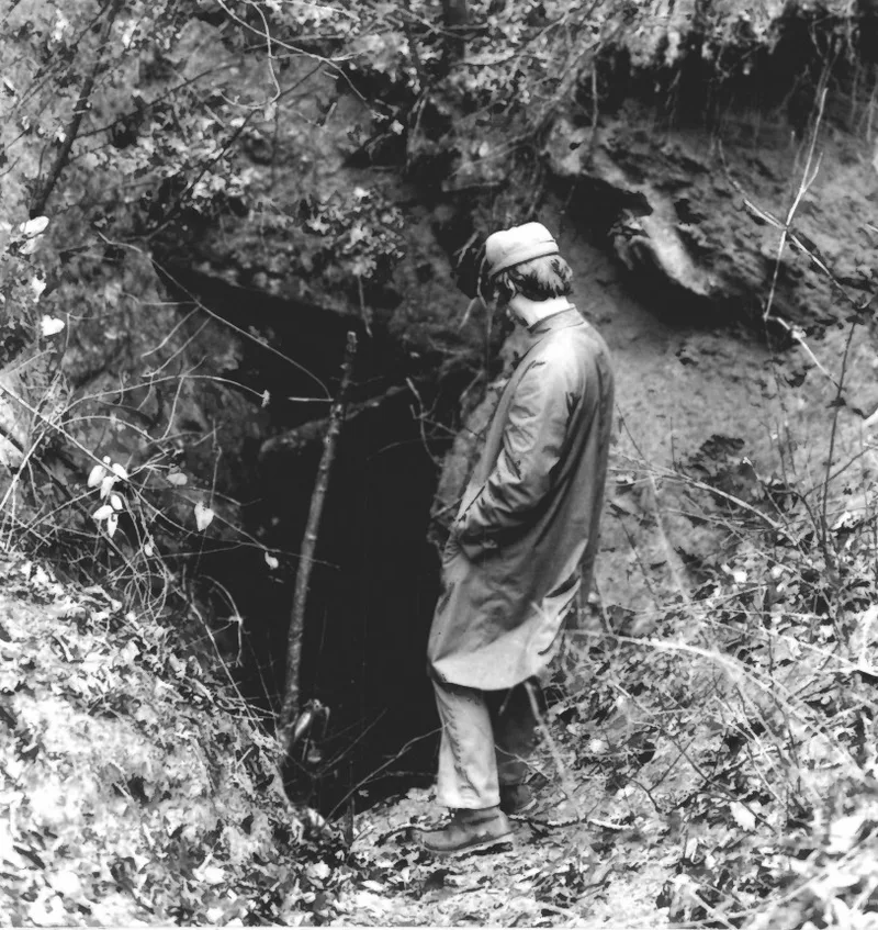
Three miles south of Dahlonega, Georgia, the Calhoun Mine climbs a ridge above the Chestatee River as a series of cuts and tunnels. The Calhoun cut runs about 150 feet into the ridge, two south tunnels run roughly 130 feet each, and later workings include the 160-foot Dugas tunnel and the 500-foot Abbot Tunnel, driven after World War II. Today only portals, diggings and overgrown cuts mark the site. Benjamin Parks found gold here in 1828. The property later passed from Reverend Robert Obarr to Judge Underwood and then to John C. Calhoun, whose descendants kept part interest until the 1880s. Because the mine lay just across the river from Cherokee country, miners soon crossed onto Cherokee land. The resulting conflict, Georgia's extension of state law over the territory in 1830, and the pressure on the Cherokee to leave are the reasons the mine is recognized as a symbol of the gold rush and Cherokee removal.
Significance in brief: The mine is presented as the emblem of Georgia's gold discovery, which drew thousands of miners onto Cherokee land. This gold rush was a leading cause of pressure to remove the Cherokee from Georgia and from the eastern homeland. The form also links the property to John C. Calhoun, whose heirs held an interest until the 1880s.
Machine-generated summary. This summary was generated by a language model from the official nomination document and has not been reviewed line by line by an editor. It may contain errors. Check the source document before relying on any detail. Source: nomination document (PDF) · National Archives catalog entry. NRHP reference 73002292, listed November 7, 1973. Summary generated October 2026 (model claude-sonnet-5-5, prompt v1.0-2026-10-29, confidence medium).
Key facts
| Address | 3 mi. S of Dahlonega off GA 60, Dahlonega |
|---|---|
| County | Lumpkin County |
| Listed | November 7, 1973 |
| Reference number | 73002292 |
| Resource type | Structure |
| Period of significance | 19th Century; specific date 1828 |
| Areas of significance | Industry, Native American, Exploration/Settlement, Politics/Government |
| Level of significance | National |
| National Historic Landmark | Yes, designated November 7, 1973 |
| Status (as stated in the nomination) | Described as in excellent condition, altered, on its original site, with preservation work in progress; the tunnels and shafts remain intact but the original cuts are partly filled and overgrown. Present use is listed as no use. |
| Acreage | 110 |
| Coordinates | 34.56148, -83.98658 (NPS GIS) |
What listing means for this property
National Register listing is honorary: it recognises significance and does not restrict what a private owner may do without federal money or permits. It unlocks the 20% federal rehabilitation tax credit for income-producing buildings, state credits in many states, and Section 106 review when federal agencies are involved. See what listing means in practice.
Noted as vacant in the nomination. Nomination documents can be decades old; current status may differ. If you are considering buying an empty listed property, read the due-diligence checklist.
General information, not legal or tax advice. Rules change; confirm with your State Historic Preservation Office or a qualified adviser.
Sources and further reading
- National Park Service, National Register of Historic Places database (snapshot May 2026), reference 73002292.
- Nomination form (PDF, National Archives) — catalog entry
- Wikipedia article (used for cross-checking only; text not reproduced here)
- Wikidata Q5019785
- This listing as JSON
Last updated October 2026. Found an error? See the editorial policy for how to report it.