Candler Park Historic District (Boundary Increase)

Why it's listed
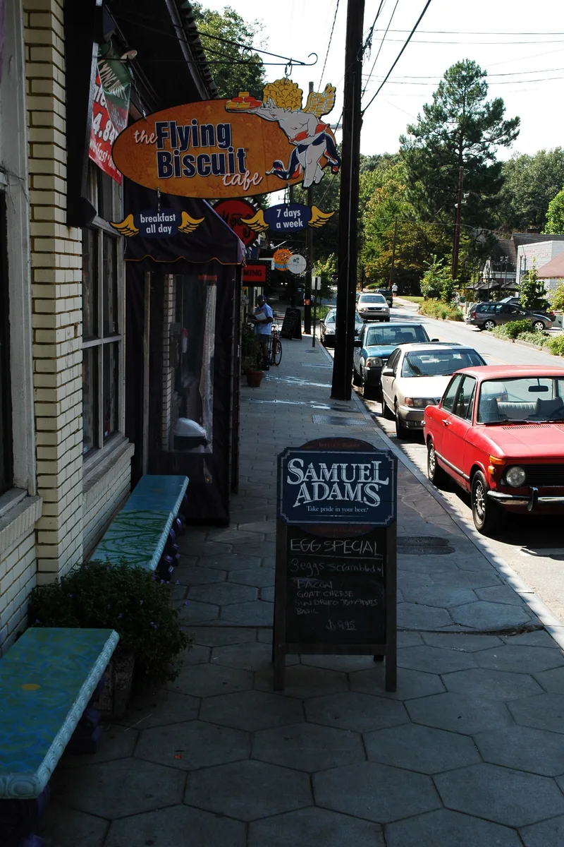
Candler Park is a residential neighborhood east of downtown Atlanta that began as Edgewood, a community along the Georgia Railroad in the 1870s. It was incorporated in 1899 and annexed by Atlanta in 1909. Candler Park itself was developed in 1922. The grid-patterned streets hold Queen Anne and Folk Victorian houses in the west, Craftsman bungalows farther east, and brick bungalows and English-style cottages from the 1920s to 1940s. Landmarks include several churches, the 1926 Mary Lin School and clusters of 1920s corner stores. This amendment, following the 1983 listing, extends the period of significance to 1955 and enlarges the northern boundary near Benning Place and Freedom Parkway. It adds 70 contributing buildings and one contributing site, including modest American Small Houses, Goldsboro Park, and the 1949 Goldsboro Apartments and Benning Place Apartments. Some earlier buildings were reclassified because of heavy alteration, and 14 were newly counted as historic.
Significance in brief: The district is argued to be significant for community planning and development as an independent railroad community that became a streetcar suburb annexed into Atlanta. It is also significant for architecture, with intact houses, commercial buildings and community landmarks typical of Georgia from about 1870 to 1955. The amendment extends the period of significance to 1955 and adds 1930s-1950s houses and modern apartment complexes.
Machine-generated summary. This summary was generated by a language model from the official nomination document and has not been reviewed line by line by an editor. It may contain errors. Check the source document before relying on any detail. Source: nomination document (PDF) · National Archives catalog entry. NRHP reference 05000140, listed March 17, 2005. Summary generated October 2026 (model claude-sonnet-5-5, prompt v1.0-2026-10-29, confidence medium).
Key facts
| Address | Roughly bounded by Moreland Ave., Freedom Pkwy., Harold Ave., Matthews St., and DeKalb Ave., Atlanta |
|---|---|
| County | DeKalb County |
| Listed | March 17, 2005 |
| Reference number | 05000140 |
| Resource type | District |
| Period of significance | c. 1870-1955 |
| Architectural style | Queen Anne, Colonial Revival, Tudor Revival, Bungalow/Craftsman, Folk Victorian, American Small House |
| Criteria |
|
| Areas of significance | Architecture, Community Planning and Development |
| Level of significance | Local |
| Status (as stated in the nomination) | Current functions listed include single and multiple dwellings, specialty stores, a school and a park; many houses have been altered, and some historic buildings were torn down for new houses. |
| Acreage | 32 |
| Within district | Druid Hills Parks and Parkways |
| Coordinates | 33.77130, -84.34343 (NPS GIS) |
What listing means for this property
This is a historic district. Buildings within its boundary are either contributing (they add to the district's significance) or non-contributing. Owners of contributing income-producing buildings can claim the 20% federal rehabilitation tax credit; homeowners should look at state credits. National Register districts impose no design review by themselves; a local historic district ordinance, if one exists, does (the difference explained).
General information, not legal or tax advice. Rules change; confirm with your State Historic Preservation Office or a qualified adviser.
Sources and further reading
- National Park Service, National Register of Historic Places database (snapshot May 2026), reference 05000140.
- Nomination form (PDF, National Archives) — catalog entry
- Wikipedia article (used for cross-checking only; text not reproduced here)
- Wikidata Q3895380
- This listing as JSON
Last updated October 2026. Found an error? See the editorial policy for how to report it.