Natural Bridge
Also known as: 081-0414

Why it's listed
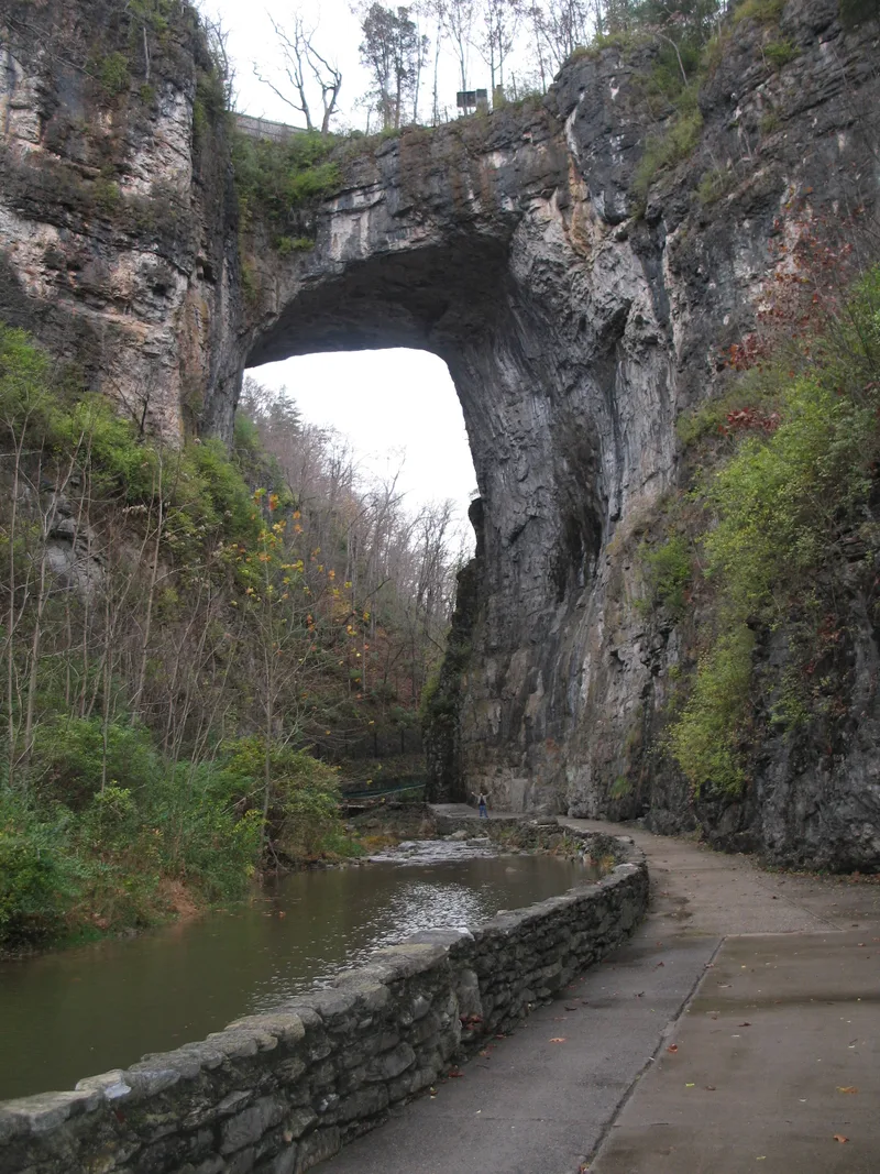
Natural Bridge is a solid limestone arch in southern Rockbridge County, Virginia, shaped over time by erosion from Cedar Creek. It is roughly 200 feet high with an unbroken span of about 90 feet, and U.S. Route 11 crosses its top. The listed site covers 5.86 acres and includes paths, walls, benches and survey markers added for visitors. In the late 1700s and early 1800s the bridge ranked alongside Niagara Falls as a leading natural wonder of the New World. Artists, writers and travelers carried its image across America and Europe, and it came to represent the sublime in nature and a developing American identity. Thomas Jefferson obtained the land by a 1774 grant, built a cabin for visitors, and wrote that he viewed the bridge as a public trust. Legends tying George Washington to the site are described as unsubstantiated. The period of significance runs from 1742 to 1860.
Significance in brief: In the Colonial and Early National periods the bridge ranked with Niagara Falls among the New World's best-known natural wonders. Its image, spread through art and travel writing, helped Americans build a national identity tied to the landscape. It was also linked to Thomas Jefferson, who owned it and described it as a public trust.
Machine-generated summary. This summary was generated by a language model from the official nomination document and has not been reviewed line by line by an editor. It may contain errors. Check the source document before relying on any detail. Source: nomination document (PDF) · National Archives catalog entry. NRHP reference 97001401, listed November 18, 1997. Summary generated October 2026 (model claude-sonnet-5-5, prompt v1.0-2026-10-29, confidence high).
Key facts
| Address | Jct. of VA 11 and VA 130, Natural Bridge |
|---|---|
| County | Rockbridge County |
| Listed | November 18, 1997 |
| Reference number | 97001401 |
| Resource type | Site |
| Period of significance | 1742-1860 |
| Criteria |
|
| Areas of significance | Transportation, Philosophy, Native American, Entertainment/Recreation, Art |
| Level of significance | National |
| National Historic Landmark | Yes, designated August 5, 1998 |
| Status (as stated in the nomination) | Still used for outdoor recreation, with a fenced top carrying U.S. Route 11; historic condition of the bridge is described as unchanged apart from visitor improvements. |
| Acreage | 5.9 |
| Coordinates | 37.62792, -79.54485 (NPS GIS) |
What listing means for this property
Sites (archaeological sites, battlefields, landscapes) are often listed with a restricted address to protect them from looting or disturbance. Listing is honorary for private owners; federal undertakings on or near the site go through Section 106 review, and state laws may protect burials and artefacts regardless of listing.
General information, not legal or tax advice. Rules change; confirm with your State Historic Preservation Office or a qualified adviser.
Sources and further reading
- National Park Service, National Register of Historic Places database (snapshot May 2026), reference 97001401.
- Nomination form (PDF, National Archives) — catalog entry
- Wikipedia article (used for cross-checking only; text not reproduced here)
- Wikidata Q1500978
- This listing as JSON
Last updated October 2026. Found an error? See the editorial policy for how to report it.