East Radford Historic District (Additional Documentation)
Also known as: 126--0084

Why it's listed
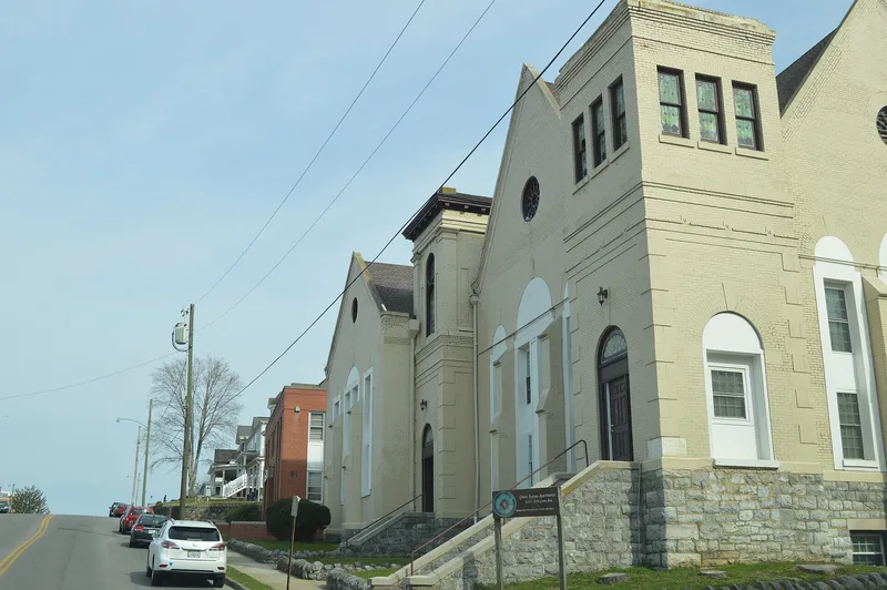
East Radford Historic District covers 141 acres in the City of Radford, Virginia, and takes in most of the historic bounds of Central Depot, later the east ward of the city. Shaped by the railroad that arrived shortly before the Civil War, it has long been the city's commercial center. Brick commercial buildings line Norwood Street south of the rail yard, among them the three-unit Bond Building and the three-story Briggs House or Simon Block. Residential streets to the south hold vernacular central-passage, side-passage and T-plan houses, grand Queen Anne residences on Grove Avenue, and bungalows and Foursquare houses from the early twentieth century. Churches, lodge buildings and the Belle Heth School add institutional variety. The district was recognized for its architecture, commerce and transportation history, with a period of significance of 1880 to 1946. Most of its buildings date from after 1880, when industrial and commercial growth turned a depot village into a regional center.
Significance in brief: The district is significant for its architecture, its commerce and its role in transportation. It reflects Radford's growth from a railroad depot village into a regional center. It holds a large, mostly post-1880 collection of commercial buildings, vernacular and Queen Anne houses, and early twentieth-century bungalows and Foursquare houses.
Machine-generated summary. This summary was generated by a language model from the official nomination document and has not been reviewed line by line by an editor. It may contain errors. Check the source document before relying on any detail. Source: nomination document (PDF) · National Archives catalog entry. NRHP reference 00000491, listed May 11, 2000. Summary generated October 2026 (model claude-sonnet-5-5, prompt v1.0-2026-10-29, confidence medium).
Key facts
| Address | Norwood, Stockton, and Downey Sts., and Grove Ave., Radford (Independent City) |
|---|---|
| County | Radford |
| Listed | May 11, 2000 |
| Reference number | 00000491 |
| Resource type | District |
| Period of significance | 1880-1946 |
| Architect / builder | W.D. Lorton and A. T. M. Rust; George R. Ragan |
| Architectural style | Late Victorian: Queen Anne; Colonial Revival; Bungalow/Craftsman |
| Criteria |
|
| Areas of significance | Architecture, Commerce, Transportation |
| Level of significance | Local |
| Status (as stated in the nomination) | Current functions listed include single and multiple dwellings, post office, business, meeting hall, school and religious facility; the Farmers' and Merchants' Bank was recently demolished. |
| Acreage | 141 |
| Within district | Stonega Historic District |
| Coordinates | 37.14048, -80.55487 (NPS GIS) |
What listing means for this property
This is a historic district. Buildings within its boundary are either contributing (they add to the district's significance) or non-contributing. Owners of contributing income-producing buildings can claim the 20% federal rehabilitation tax credit; homeowners should look at state credits. National Register districts impose no design review by themselves; a local historic district ordinance, if one exists, does (the difference explained).
General information, not legal or tax advice. Rules change; confirm with your State Historic Preservation Office or a qualified adviser.
Sources and further reading
- National Park Service, National Register of Historic Places database (snapshot May 2026), reference 00000491.
- Nomination form (PDF, National Archives) — catalog entry
- Wikipedia article (used for cross-checking only; text not reproduced here)
- Wikidata Q16834373
- This listing as JSON
Last updated October 2026. Found an error? See the editorial policy for how to report it.