Goose Creek Stone Bridge

Why it's listed
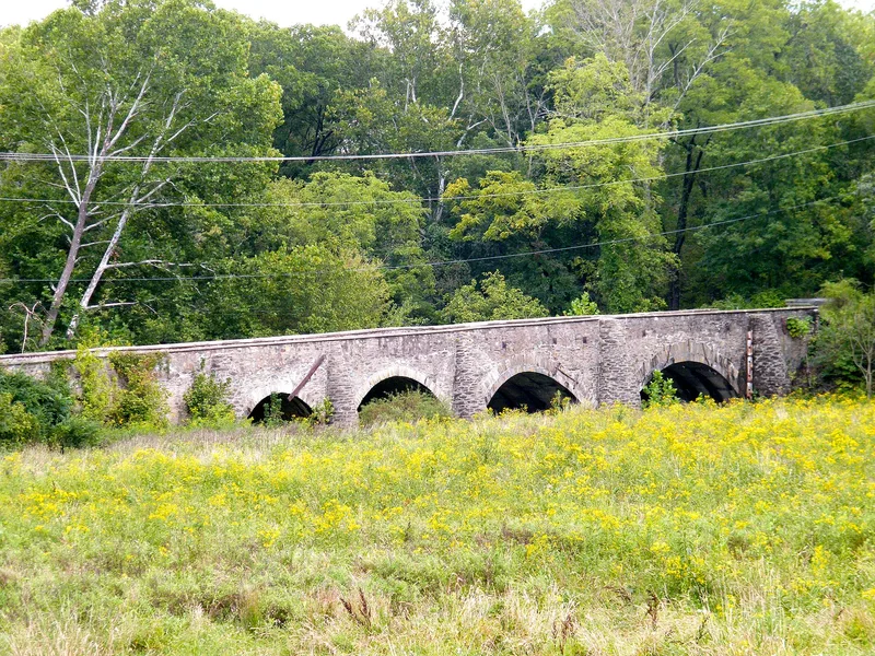
Goose Creek Stone Bridge is a four-span turnpike bridge of rubble fieldstone, roughly 200 feet long, located about two miles northwest of U.S. Route 50 near Atoka in Loudoun County. Its segmental arches are framed by demi-conical stone buttresses, and triangular buttresses support the ramp at the western end. The two eastern arches are reinforced underneath with cast concrete, and the two eastern spans cross the creek while the western two cross bottom land. The exact construction date is unknown, but it could be as early as 1810, when the General Assembly authorized extending the Ashby's Gap Turnpike. An 1820 report refers to tolls collected at or near the bridge. It is described as the largest and most scenically situated early stone turnpike bridge in northern Virginia. A new Route 50 bridge built in the 1950s left the old structure unused, though more visible as a landmark. The stonework has been repointed, and metal tie rods halt a spreading along its center line.
Significance in brief: The nomination calls it the largest and most scenically situated of the early stone turnpike bridges of northern Virginia. It may date from as early as 1810, when the Ashby's Gap Turnpike was authorized. It is documented in an 1820 Board of Public Works report. Engineering and transportation are the areas of significance marked.
Machine-generated summary. This summary was generated by a language model from the official nomination document and has not been reviewed line by line by an editor. It may contain errors. Check the source document before relying on any detail. Source: nomination document (PDF) · National Archives catalog entry. NRHP reference 74002134, listed October 9, 1974. Summary generated October 2026 (model claude-sonnet-5-5, prompt v1.0-2026-10-29, confidence high).
Key facts
| Address | NW of Atoka off U.S. 50, Atoka |
|---|---|
| County | Loudoun County |
| Listed | October 9, 1974 |
| Reference number | 74002134 |
| Resource type | Structure |
| Period of significance | 19th Century |
| Areas of significance | Engineering, Transportation |
| Level of significance | State |
| Status (as stated in the nomination) | Neither used nor maintained; condition marked fair, generally structurally sound but needing clearing and minor repair. The Highway Department intends to offer title to any agency that will take responsibility for preservation. |
| Acreage | 26 |
| Within district | Cromwell's Run Rural Historic District (Boundary Increase) |
| Coordinates | 38.98202, -77.81954 (NPS GIS) |
What listing means for this property
For a publicly owned building or structure, listing mainly matters when federal funds, permits or licences are involved: projects then go through Section 106 review so effects on the property are considered. Listing also strengthens applications for preservation grants and, for leased income-producing uses, can enable the federal rehabilitation tax credit.
Noted as vacant in the nomination. Nomination documents can be decades old; current status may differ. If you are considering buying an empty listed property, read the due-diligence checklist.
General information, not legal or tax advice. Rules change; confirm with your State Historic Preservation Office or a qualified adviser.
Sources and further reading
- National Park Service, National Register of Historic Places database (snapshot May 2026), reference 74002134.
- Nomination form (PDF, National Archives) — catalog entry
- Wikipedia article (used for cross-checking only; text not reproduced here)
- Wikidata Q5584048
- This listing as JSON
Last updated October 2026. Found an error? See the editorial policy for how to report it.