Crednal
Also known as: Dhr #053-0141

Why it's listed
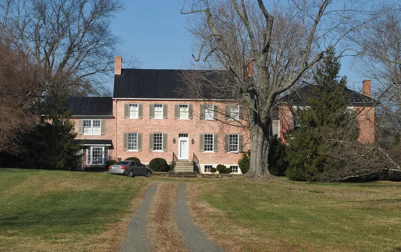
Crednal is a 76-acre farm property in southwestern Loudoun County, Virginia, built around an older stone room. The earliest part is a ca. 1785 one-and-a-half-story stone cell, about 16 by 16 feet. Around 1814 a two-story, five-bay Federal-style brick house was constructed around it, an unusual approach that required a lateral stair hall rather than the typical center-passage plan. The stone section remains visible on the rear elevation. A frame wing was added in 1870, and in 1992-93 a Greek Revival brick house moved from Greene County was attached to the east end. The grounds include a Carter family cemetery and an unmarked burial ground that may hold African-American graves. The property is associated with John Armistead Carter, who bought it in 1841, farmed there, and served in the Virginia General Assembly and Senate. The interior remains well preserved, and the setting of fences, fields and a long drive retains its rural character.
Significance in brief: The form argues that the house is an unusual early-19th-century dwelling because a small stone cell was built into a larger brick I-house, producing a rare lateral-stair-and-hall plan. The property is also tied to John Armistead Carter, a planter, lawyer and political leader in Loudoun County and Virginia, and to the Hall, DeButts and Dulany families. Its cemeteries, including a probable African-American burial ground, add to its significance.
Machine-generated summary. This summary was generated by a language model from the official nomination document and has not been reviewed line by line by an editor. It may contain errors. Check the source document before relying on any detail. Source: nomination document (PDF) · National Archives catalog entry. NRHP reference 11000034, listed February 22, 2011. Summary generated October 2026 (model claude-sonnet-5-5, prompt v1.0-2026-10-29, confidence medium).
Key facts
| Address | 34500 Welbourne Rd, Middleburg |
|---|---|
| County | Loudoun County |
| Listed | February 22, 2011 |
| Reference number | 11000034 |
| Resource type | Building |
| Architectural style | Early Republic: Federal; Other: Vernacular |
| Areas of significance | Architecture, Politics/Government |
| Level of significance | Local |
| Status (as stated in the nomination) | Private property in use as a single dwelling with secondary structures, agricultural outbuildings and a cemetery; described as well kempt and retaining its historic rural character. |
| Acreage | 76 |
| Coordinates | 39.00702, -77.81211 (NPS GIS) |
What listing means for this property
National Register listing is honorary: it recognises significance and does not restrict what a private owner may do without federal money or permits. It unlocks the 20% federal rehabilitation tax credit for income-producing buildings, state credits in many states, and Section 106 review when federal agencies are involved. See what listing means in practice.
General information, not legal or tax advice. Rules change; confirm with your State Historic Preservation Office or a qualified adviser.
Sources and further reading
- National Park Service, National Register of Historic Places database (snapshot May 2026), reference 11000034.
- Nomination form (PDF, National Archives) — catalog entry
- Wikipedia article (used for cross-checking only; text not reproduced here)
- Wikidata Q14712211
- This listing as JSON
Last updated October 2026. Found an error? See the editorial policy for how to report it.