Benjamin Banneker: SW 9 Intermediate Boundary Stone
Also known as: Intermediate Stone of the District of Columbia

Why it's listed
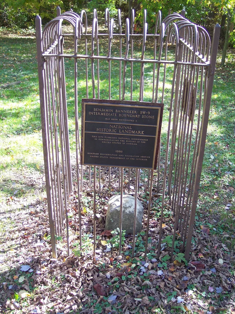
A small sandstone marker in Falls Church Park, at 18th Street and Van Buren Drive in Arlington, Virginia, records the original boundary of the District of Columbia. Known as SW-9, it is one of forty intermediate stones set along the ten-mile square in 1791 and 1792. Each was a foot-square block of sandstone inscribed with the jurisdiction, the state name, the year and the magnetic variance. This stone now rises about 15 inches above ground, is sinking, and sits inside a dark green iron fence directly on the line between Arlington County and the City of Falls Church. Its significance comes from Benjamin Banneker, the Maryland-born mathematician, astronomer and almanac author who assisted Major Andrew Ellicott in surveying the new Federal City. Banneker built a wooden striking clock in 1753, published almanacs, and wrote to Thomas Jefferson challenging his views on Black intellect. The stone commemorates his public service to the new nation.
Significance in brief: The nomination ties the stone to Benjamin Banneker (1731-1806), a self-taught mathematician, astronomer, almanac writer and surveyor. He served as scientific assistant to Major Andrew Ellicott in surveying the Federal City and its boundary. The form presents him as one of the most famous Black Americans of his era and as evidence of Afro-American contributions to the young nation.
Machine-generated summary. This summary was generated by a language model from the official nomination document and has not been reviewed line by line by an editor. It may contain errors. Check the source document before relying on any detail. Source: nomination document (PDF) · National Archives catalog entry. NRHP reference 76002094, listed May 11, 1976. Summary generated October 2026 (model claude-sonnet-5-5, prompt v1.0-2026-10-29, confidence medium).
Key facts
| Address | 18th and Van Buren Sts., Arlington |
|---|---|
| County | Arlington County |
| Listed | May 11, 1976 |
| Reference number | 76002094 |
| Resource type | Object |
| Period of significance | 1792-present |
| Areas of significance | Community Planning and Development, Agriculture, Engineering, Black, Science, Social History, Invention |
| Level of significance | National |
| National Historic Landmark | Yes, designated May 11, 1976 |
| Status (as stated in the nomination) | Stone is about 15 inches above ground, sinking, with a worn top and inscriptions largely unreadable; its bronze plaque is missing and held by the county survey office, and an iron fence surrounds it. The form lists it as altered and unoccupied. |
| Acreage | 0.9 |
| Coordinates | 38.89211, -77.15917 (NPS GIS) |
What listing means for this property
National Register listing is honorary: it recognises significance and does not restrict what a private owner may do without federal money or permits. It unlocks the 20% federal rehabilitation tax credit for income-producing buildings, state credits in many states, and Section 106 review when federal agencies are involved. See what listing means in practice.
General information, not legal or tax advice. Rules change; confirm with your State Historic Preservation Office or a qualified adviser.
Sources and further reading
- National Park Service, National Register of Historic Places database (snapshot May 2026), reference 76002094.
- Nomination form (PDF, National Archives) — catalog entry
- Wikipedia article (used for cross-checking only; text not reproduced here)
- Wikidata Q4888239
- This listing as JSON
Last updated October 2026. Found an error? See the editorial policy for how to report it.