DeLeon Plaza and Bandstand

Why it's listed
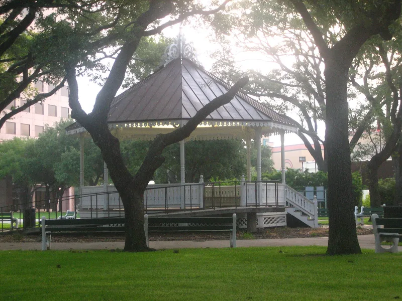
DeLeon Plaza, in the 100 block of West Constitution Street in Victoria, Texas, is a public square that began as one of two set aside in Ed Linn's 1839 town plan. It is the only one that still serves its original public function. At its center stands an octagonal, raised wood-frame bandstand from about 1885, with a composition shingle roof, a wooden spire at the peak, turned posts, and jig-sawn balustrade and brackets. The bandstand was moved to the middle of the park in 1923. Naturalist J. D. Mitchell reshaped the square in the early twentieth century by replacing brittle hackberry trees with sturdier native pecans, many of which still ring the block. This changed the square from a mostly utilitarian open space into a shaded recreational park, uncommon for small Texas towns then. A 1940 Public Works Administration project added grading, sidewalks, benches and two monuments. The site is listed for community planning and landscape architecture.
Significance in brief: It is one of two public squares set aside in the 1839 town plan and the only one that still serves its original function. Its present layout combines the 1885 bandstand, early twentieth-century pecan plantings by naturalist J. D. Mitchell, and a 1940 PWA project. Reviewers accepted it for community planning and landscape architecture.
Machine-generated summary. This summary was generated by a language model from the official nomination document and has not been reviewed line by line by an editor. It may contain errors. Check the source document before relying on any detail. Source: nomination document (PDF) · National Archives catalog entry. NRHP reference 86002584, listed March 24, 1987. Summary generated October 2026 (model claude-sonnet-5-5, prompt v1.0-2026-10-29, confidence medium).
Key facts
| Address | 100 blk. W. Constitution, Victoria |
|---|---|
| County | Victoria County |
| Listed | March 24, 1987 |
| Reference number | 86002584 |
| Resource type | Site |
| Architectural style | Victorian bandstand (octagonal, wood frame with jig-sawn detailing) |
| Criteria |
|
| Areas of significance | Community Planning and Development, Landscape Architecture |
| Level of significance | State, Local |
| Status (as stated in the nomination) | Present use is a park. |
| Acreage | 0.9 |
| Coordinates | 28.79951, -97.00641 (NPS GIS) |
What listing means for this property
Sites (archaeological sites, battlefields, landscapes) are often listed with a restricted address to protect them from looting or disturbance. Listing is honorary for private owners; federal undertakings on or near the site go through Section 106 review, and state laws may protect burials and artefacts regardless of listing.
General information, not legal or tax advice. Rules change; confirm with your State Historic Preservation Office or a qualified adviser.
Sources and further reading
- National Park Service, National Register of Historic Places database (snapshot May 2026), reference 86002584.
- Nomination form (PDF, National Archives) — catalog entry
- Wikipedia article (used for cross-checking only; text not reproduced here)
- Wikidata Q5243985
- This listing as JSON
Last updated October 2026. Found an error? See the editorial policy for how to report it.