Chamizal National Memorial
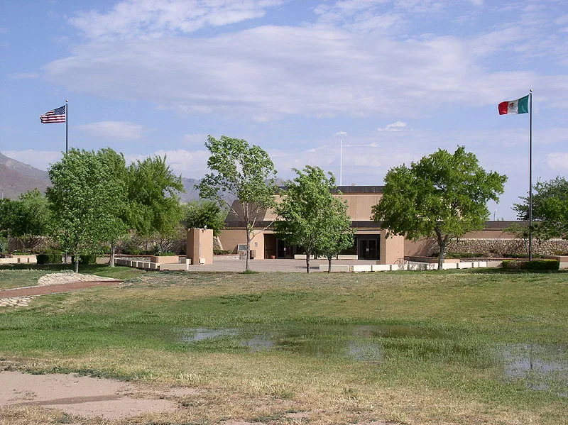

Why it's listed
Chamizal National Memorial is a 54.9-acre park in midtown El Paso, Texas, built on land the United States acquired from Mexico in the 1963 Chamizal Settlement. Congress authorized it in 1966 to commemorate how the two nations peacefully worked through boundary problems dating from 1848, ending with the last major land disagreement between them. Plans went beyond commemoration to include an urban park and a center for cultural exchange, with a 500-seat theater, a 4,000-seat amphitheater, a museum, and programs in the graphic and performing arts. Landscaping was designed around native desert plants that need little water, and an environmental study area was proposed. By early 1973, construction from fiscal years 1968 to 1972 had provided utilities, 34 acres of grass, an automatic sprinkler system, roads and a visitor center. Rising costs left exhibits, seating and some landscaping unfunded, and a request was made to raise the development ceiling to $5,445,000. The available documents are mostly funding and staffing papers.
Significance in brief: The memorial commemorates the peaceful resolution of boundary disputes between the United States and Mexico, from 1848 to the Chamizal Settlement of 1963, which resolved the last major land disagreement between the two nations. It was also planned as a center for international and cultural exchange.
Machine-generated summary. This summary was generated by a language model from the official nomination document and has not been reviewed line by line by an editor. It may contain errors. Check the source document before relying on any detail. Source: nomination document (PDF) · National Archives catalog entry. NRHP reference 74002069, listed February 4, 1974. Summary generated October 2026 (model claude-sonnet-5-5, prompt v1.0-2026-10-29, confidence low).
Key facts
| Address | Paisano Dr., El Paso |
|---|---|
| County | El Paso County |
| Listed | February 4, 1974 |
| Reference number | 74002069 |
| Resource type | District |
| Areas of significance | Politics/Government |
| Level of significance | National |
| Status (as stated in the nomination) | Under development in 1973: a visitor center, roads and utilities were under construction, with opening to the public expected in late spring or early summer 1973. |
| Acreage | 54.9 |
| Within district | Sunset Heights Historic District |
| Coordinates | 31.75997, -106.49990 (NPS GIS) |
What listing means for this property
This is a historic district. Buildings within its boundary are either contributing (they add to the district's significance) or non-contributing. Owners of contributing income-producing buildings can claim the 20% federal rehabilitation tax credit; homeowners should look at state credits. National Register districts impose no design review by themselves; a local historic district ordinance, if one exists, does (the difference explained).
General information, not legal or tax advice. Rules change; confirm with your State Historic Preservation Office or a qualified adviser.
Sources and further reading
- National Park Service, National Register of Historic Places database (snapshot May 2026), reference 74002069.
- Nomination form (PDF, National Archives) — catalog entry
- Wikipedia article (used for cross-checking only; text not reproduced here)
- Wikidata Q142686
- This listing as JSON
Last updated October 2026. Found an error? See the editorial policy for how to report it.