Old City Historic District
Also known as: See Also:Independence National Historical Park

Why it's listed
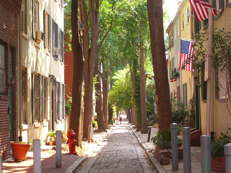
Central Philadelphia's Old City district is a dense mix of brick warehouses, storefronts, churches and houses laid out within William Penn's 1682 plan of the city. Its commercial core is the main draw, with blocks of early-19th-century warehouses on North Front Street and a catalogue of mid-19th-century facades on Chestnut Street. The John Singer warehouse behind 319 Market Street, built in 1806, is described as the oldest surviving warehouse in Philadelphia. Alongside the commercial blocks are 18th-century residences, including Elfreth's Alley, which dates to the 18th century and has been continuously inhabited. Churches such as Christ Church, built between 1727 and 1744, and St. George's Methodist Episcopal Church, built in 1769, add to its historic character. Its banks, including the Bank of North America, chartered in 1781, further reflect the city's early financial life.
Significance in brief: The nomination argues that the area preserves rare surviving 19th-century commercial districts, probably without equal in the United States for their extent and diversity. It also cites its 18th-century residences, historic churches and important financial institutions, and its place in the original 1682 plan of Philadelphia laid out by Thomas Holme.
Machine-generated summary. This summary was generated by a language model from the official nomination document and has not been reviewed line by line by an editor. It may contain errors. Check the source document before relying on any detail. Source: nomination document (PDF) · National Archives catalog entry. NRHP reference 72000093, listed May 5, 1972. Summary generated October 2026 (model claude-haiku-5-5, prompt v1.1-2026-10-29, confidence medium).
Key facts
| Address | Old city area including parts of Washington Square East Development Area and Franklin Square East Development Area, Philadelphia |
|---|---|
| County | Philadelphia |
| Listed | May 5, 1972 |
| Reference number | 72000093 |
| Resource type | District |
| Period of significance | 18th Century to 20th Century |
| Criteria |
|
| Areas of significance | Commerce, Architecture, Religion |
| Level of significance | National |
| Status (as stated in the nomination) | Several buildings have been restored or are being renovated for shops and homes, while others are altered but largely retain their exteriors. |
| Acreage | 75 |
| Within district | Independence National Historical Park |
| Coordinates | 39.95071, -75.14532 (NPS GIS) |
What listing means for this property
This is a historic district. Buildings within its boundary are either contributing (they add to the district's significance) or non-contributing. Owners of contributing income-producing buildings can claim the 20% federal rehabilitation tax credit; homeowners should look at state credits. National Register districts impose no design review by themselves; a local historic district ordinance, if one exists, does (the difference explained).
General information, not legal or tax advice. Rules change; confirm with your State Historic Preservation Office or a qualified adviser.
Sources and further reading
- National Park Service, National Register of Historic Places database (snapshot May 2026), reference 72000093.
- Nomination form (PDF, National Archives) — catalog entry
- Wikipedia article (used for cross-checking only; text not reproduced here)
- Wikidata Q7083678
- This listing as JSON
Last updated October 2026. Found an error? See the editorial policy for how to report it.