Penn, William, Landing Site

Why it's listed
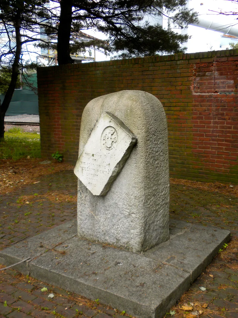
Along the Delaware River in Chester, a granite memorial stone marks the place where William Penn came ashore on October 28 and 29, 1682. Erected in 1882 and designed by John Struthers of Philadelphia, the marker stands about five feet high and carries a marble tablet bearing Penn's coat of arms and an inscription recording the landing. Penn arrived aboard the ship Welcome, and a passenger, Evan Oliver, recorded the arrival at Upland, later renamed Chester. The site also includes the location of Robert Wade's log house, bought from one of Governor Printz's daughters. Wade's home is connected to the first Quaker meeting in Pennsylvania, reportedly held there in 1676, and Penn spent his first night in the colony in the house. The place is important for linking the colony's founding to its early religious community.
Significance in brief: The site is associated with Penn's arrival in Pennsylvania and with the location of Robert Wade's log house, where Penn spent his first night in the colony. The document also links the house to an early Quaker meeting held there in 1676.
Machine-generated summary. This summary was generated by a language model from the official nomination document and has not been reviewed line by line by an editor. It may contain errors. Check the source document before relying on any detail. Source: nomination document (PDF) · National Archives catalog entry. NRHP reference 71000703, listed March 11, 1971. Summary generated October 2026 (model claude-haiku-5-5, prompt v1.1-2026-10-29, confidence medium).
Key facts
| Address | Penn and Front Sts., Chester |
|---|---|
| County | Delaware County |
| Listed | March 11, 1971 |
| Reference number | 71000703 |
| Resource type | Site |
| Period of significance | 17th Century |
| Architect / builder | John Struthers of Philadelphia (designer of the memorial) |
| Areas of significance | Exploration/Settlement, Religion |
| Level of significance | National |
| Acreage | 0.9 |
| Coordinates | 39.84343, -75.36103 (NPS GIS) |
What listing means for this property
Sites (archaeological sites, battlefields, landscapes) are often listed with a restricted address to protect them from looting or disturbance. Listing is honorary for private owners; federal undertakings on or near the site go through Section 106 review, and state laws may protect burials and artefacts regardless of listing.
General information, not legal or tax advice. Rules change; confirm with your State Historic Preservation Office or a qualified adviser.
Sources and further reading
- National Park Service, National Register of Historic Places database (snapshot May 2026), reference 71000703.
- Nomination form (PDF, National Archives) — catalog entry
- Wikipedia article (used for cross-checking only; text not reproduced here)
- Wikidata Q8016760
- This listing as JSON
Last updated October 2026. Found an error? See the editorial policy for how to report it.