Brandywine Battlefield

Why it's listed
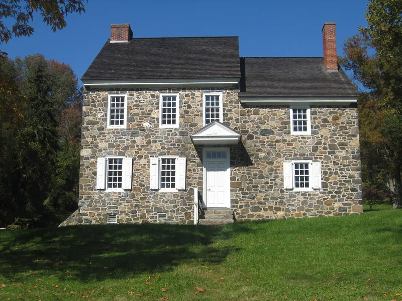
Brandywine Battlefield covers roughly seven thousand acres around Chadds Ford in Delaware County, Pennsylvania, where Washington's Continental Army fought Howe's British forces on September 11, 1777. Howe sent a force under Knyphausen across the Brandywine at Chadds Ford while Cornwallis marched twelve miles north and crossed at Jefferis Ford, flanking the American line. Washington's intelligence on the flanking movement was contradicted by a later report, and Sullivan's line broke near the Birmingham Meetinghouse. Greene held a delaying action while Wayne's troops at the ford were forced back. Nightfall ended the fighting, and the Americans withdrew to Chester. The landmark is significant as the only major clash in the campaign against Philadelphia, and the district includes stone houses dating from the 1700s, the Birmingham Friends Meetinghouse, Brinton's Mill, and the Ring House and Gideon Gilpin House within the state park.
Significance in brief: The nomination argues the battle was the only major clash between Washington's Continentals and Howe's British forces during the campaign that captured Philadelphia. Although the Americans were defeated, the form states the Continentals showed they could withstand a determined attack by British regulars. The surrounding farmland and stone buildings are described as remaining largely unchanged from the time of the battle.
Machine-generated summary. This summary was generated by a language model from the official nomination document and has not been reviewed line by line by an editor. It may contain errors. Check the source document before relying on any detail. Source: nomination document (PDF) · National Archives catalog entry. NRHP reference 66000660, listed October 15, 1966. Summary generated October 2026 (model claude-haiku-5-5, prompt v1.1-2026-10-29, confidence medium).
Key facts
| Address | Brandywine Battlefield Park, Chadds Ford |
|---|---|
| County | Delaware County |
| Listed | October 15, 1966 |
| Reference number | 66000660 |
| Resource type | District |
| Period of significance | September 11, 1777 |
| Areas of significance | Military |
| Level of significance | National |
| National Historic Landmark | Yes, designated January 20, 1961 |
| Status (as stated in the nomination) | Much of the land remains farmland and woodland, with some later structures and an electric power line noted as intrusions. The state maintains a 50-acre park on Route 1. |
| Acreage | 6100 |
| Coordinates | 39.88882, -75.58353 (NPS GIS) |
What listing means for this property
This is a historic district. Buildings within its boundary are either contributing (they add to the district's significance) or non-contributing. Owners of contributing income-producing buildings can claim the 20% federal rehabilitation tax credit; homeowners should look at state credits. National Register districts impose no design review by themselves; a local historic district ordinance, if one exists, does (the difference explained).
General information, not legal or tax advice. Rules change; confirm with your State Historic Preservation Office or a qualified adviser.
Sources and further reading
- National Park Service, National Register of Historic Places database (snapshot May 2026), reference 66000660.
- Nomination form (PDF, National Archives) — catalog entry
- Wikipedia article (used for cross-checking only; text not reproduced here)
- Wikidata Q4957272
- This listing as JSON
Last updated October 2026. Found an error? See the editorial policy for how to report it.