West Chester Historic District (Boundary Increase)

Why it's listed
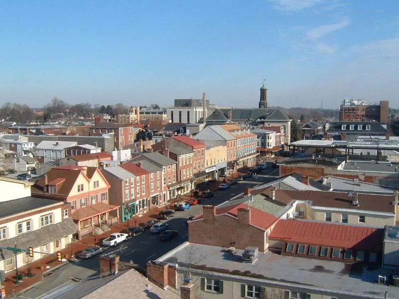
West Chester grew from a crossroads village at the Wilmington and Philadelphia roads, and became the Chester County seat after the courthouse was relocated there in 1784. This proposed district extends the original downtown district into surrounding residential and industrial areas, covering about 60 percent of the borough. It contains 4,028 resources, most of them contributing buildings dating from the eighteenth to the mid-twentieth century. Subdivisions of former farms in the early nineteenth century produced long narrow lots lined with brick rowhouses. After the West Chester Railroad opened in 1833, industries such as the Hoopes Brothers and Darlington Wheel Works and the Sharples Separator Works developed along the rail corridor. Worker housing in neighborhoods like Riggtown reflects the immigrant labor that sustained these industries. The district's significance rests on its intact collection of buildings that document this development, and the nomination extends the period of significance to 1954.
Significance in brief: The nomination argues that resources outside the original district reflect the borough's growth from the mid-eighteenth through mid-twentieth centuries, including its role as county seat, its railroad-era industries and its working-class neighborhoods. It extends the period of significance of the existing district to 1954 to include mid-twentieth century buildings. Under criterion C it contends the resources reflect regionally popular architectural styles and the borough's urban growth pattern.
Machine-generated summary. This summary was generated by a language model from the official nomination document and has not been reviewed line by line by an editor. It may contain errors. Check the source document before relying on any detail. Source: nomination document (PDF) · National Archives catalog entry. NRHP reference 05000096, listed February 27, 2005. Summary generated October 2026 (model claude-haiku-5-5, prompt v1.1-2026-10-29, confidence medium).
Key facts
| Address | Roughly bounded by West Chester's northern boundary,Poplar St., East Rosedale Ave., and South Bradford Ave., West Chester |
|---|---|
| County | Chester County |
| Listed | February 27, 2005 |
| Reference number | 05000096 |
| Resource type | District |
| Period of significance | c. 1750-1954 |
| Criteria |
|
| Areas of significance | Commerce, Politics/Government, Architecture |
| Level of significance | Local |
| Status (as stated in the nomination) | The district has lost less than two percent of its contributing buildings since 1985, mostly to fire or demolition, and has changed very little in recent decades. |
| Acreage | 521.4 |
| Within district | West Chester Downtown Historic District |
| Coordinates | 39.95788, -75.60424 (NPS GIS) |
What listing means for this property
This is a historic district. Buildings within its boundary are either contributing (they add to the district's significance) or non-contributing. Owners of contributing income-producing buildings can claim the 20% federal rehabilitation tax credit; homeowners should look at state credits. National Register districts impose no design review by themselves; a local historic district ordinance, if one exists, does (the difference explained).
General information, not legal or tax advice. Rules change; confirm with your State Historic Preservation Office or a qualified adviser.
Sources and further reading
- National Park Service, National Register of Historic Places database (snapshot May 2026), reference 05000096.
- Nomination form (PDF, National Archives) — catalog entry
- Wikipedia article (used for cross-checking only; text not reproduced here)
- Wikidata Q7984713
- This listing as JSON
Last updated October 2026. Found an error? See the editorial policy for how to report it.