Duquesne Incline

Why it's listed
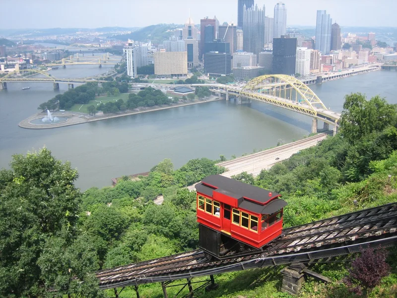
Built on Mt. Washington above Pittsburgh, the Duquesne Incline opened in 1877 with wood and iron construction and was rebuilt entirely in iron in 1888. It rises about 400 feet over a length of 793 feet, with two cars moving in opposite directions on a double track, each pulled by steel cables wound on a large drum powered by two 200-horsepower electric motors. Inclines like this one allowed hilltop housing to develop, since the riverside mills left little land for homes. The Duquesne Incline was the fourth such incline built in the city, at a cost of $47,000, and was designed and built by Samuel Diescher, who built or rebuilt ten of the seventeen local inclines. It is one of only two of those seventeen that remain. In 1963 the Port Authority of Allegheny County took it over and leased it back to a preservation society that funded repairs. Commuters and tourists still ride it, with views of the confluence of the Monongahela and Allegheny rivers.
Significance in brief: The nomination argues the incline is significant for its role in Pittsburgh's hillside housing growth and rapid transit, since mills occupied the riverbanks and residents moved to the surrounding hills. It is also significant for its engineering as one of only two surviving of the seventeen inclines once operating in the Pittsburgh area, and for the work of its builder, Samuel Diescher.
Machine-generated summary. This summary was generated by a language model from the official nomination document and has not been reviewed line by line by an editor. It may contain errors. Check the source document before relying on any detail. Source: nomination document (PDF) · National Archives catalog entry. NRHP reference 75001609, listed March 4, 1975. Summary generated October 2026 (model claude-haiku-5-5, prompt v1.1-2026-10-29, confidence high).
Key facts
| Address | 1220 Grandview Ave., Pittsburgh |
|---|---|
| County | Allegheny County |
| Listed | March 4, 1975 |
| Reference number | 75001609 |
| Resource type | Structure |
| Period of significance | 1877-1888 |
| Architect / builder | Samuel Diescher (designer and builder) |
| Areas of significance | Engineering, Transportation |
| Level of significance | Local |
| Status (as stated in the nomination) | In use; repaired and restored after 1963 when the Port Authority of Allegheny County took it over and leased it to a preservation society. |
| Acreage | 5 |
| Coordinates | 40.43920, -80.01774 (NPS GIS) |
What listing means for this property
National Register listing is honorary: it recognises significance and does not restrict what a private owner may do without federal money or permits. It unlocks the 20% federal rehabilitation tax credit for income-producing buildings, state credits in many states, and Section 106 review when federal agencies are involved. See what listing means in practice.
General information, not legal or tax advice. Rules change; confirm with your State Historic Preservation Office or a qualified adviser.
Sources and further reading
- National Park Service, National Register of Historic Places database (snapshot May 2026), reference 75001609.
- Nomination form (PDF, National Archives) — catalog entry
- Wikipedia article (used for cross-checking only; text not reproduced here)
- Wikidata Q1266663
- This listing as JSON
Last updated October 2026. Found an error? See the editorial policy for how to report it.