Cascade Locks Historic District
Also known as: Ohio & Erie Canal Locks 10-18; See Also:Valley Railway Histor

Why it's listed
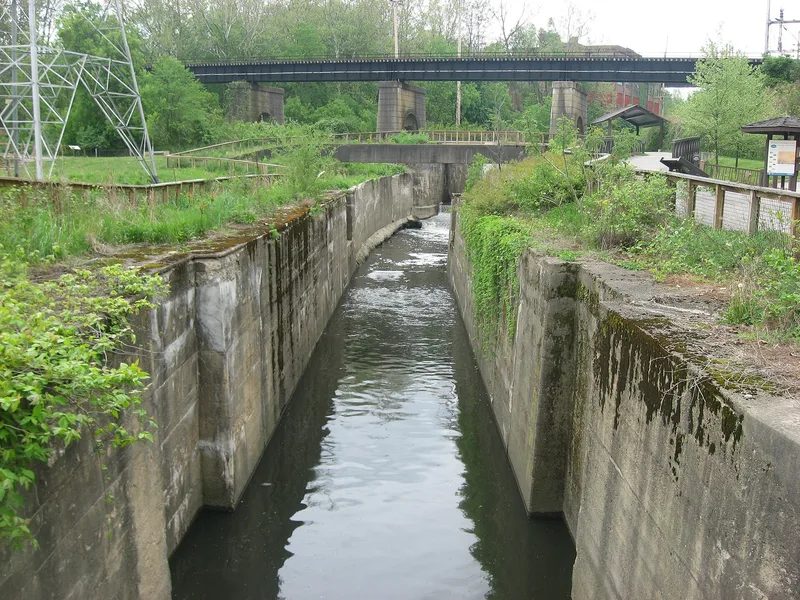
Northwest of downtown Akron, a ravine holds a string of Ohio & Erie Canal locks, numbers 10 through 18, along with wasteways, a mill race, a diversion dam, railroad bridges and a handful of industrial and residential buildings. The sandstone locks, each with a 90-foot chamber 15 feet wide, were lined with concrete during the 1907-11 statewide renovation, though original stone remains visible at the base of most walls. Canal construction began in 1825 alongside the founding of Akron, and the number of locks slowed travel enough to foster the town's growth. Mills drew power from a parallel hydraulic race, and later a steam plant, a rubber factory and rail lines, including a spur serving the valley's industries, joined the landscape. Buildings include a Greek Revival house built for Frederick Mustill. The district was listed for its local importance in industry, transportation, architecture and engineering, covering the years 1827 to 1930.
Significance in brief: The nomination argues the district is significant locally under Criteria A and C in the areas of industry, transportation, architecture and engineering. The flight of locks in the ravine drove Akron's early growth and powered mills and factories. The surviving locks, race, bridges and buildings document that canal, industrial and railroad history.
Machine-generated summary. This summary was generated by a language model from the official nomination document and has not been reviewed line by line by an editor. It may contain errors. Check the source document before relying on any detail. Source: nomination document (PDF) · National Archives catalog entry. NRHP reference 92001627, listed December 10, 1992. Summary generated October 2026 (model claude-sonnet-5-5, prompt v1.0-2026-10-29, confidence medium).
Key facts
| Address | Roughly bounded by North, Howard, Innerbelt Rt. 59 and the canal from Locks 10 to 16, including discontiguous parts N, Akron |
|---|---|
| County | Summit County |
| Listed | December 10, 1992 |
| Reference number | 92001627 |
| Resource type | District |
| Period of significance | 1827 - 1930 |
| Architect / builder | Unknown |
| Architectural style | Commercial Style, Greek Revival, No Style |
| Criteria |
|
| Areas of significance | Industry, Engineering, Transportation, Architecture |
| Level of significance | Local |
| Status (as stated in the nomination) | Locks are mostly intact, though some are partly destroyed and the canal is unwatered between Locks 15 and 17. An American Rubber Company building is still used for manufacturing, and part of the district is listed as vacant or not in use. |
| Acreage | 25 |
| Coordinates | 41.09440, -81.52130 (NPS GIS) |
What listing means for this property
This is a historic district. Buildings within its boundary are either contributing (they add to the district's significance) or non-contributing. Owners of contributing income-producing buildings can claim the 20% federal rehabilitation tax credit; homeowners should look at state credits. National Register districts impose no design review by themselves; a local historic district ordinance, if one exists, does (the difference explained).
General information, not legal or tax advice. Rules change; confirm with your State Historic Preservation Office or a qualified adviser.
Sources and further reading
- National Park Service, National Register of Historic Places database (snapshot May 2026), reference 92001627.
- Nomination form (PDF, National Archives) — catalog entry
- Wikipedia article (used for cross-checking only; text not reproduced here)
- Wikidata Q5048146
- This listing as JSON
Last updated October 2026. Found an error? See the editorial policy for how to report it.