Fort Defiance Park
Also known as: De-26

Why it's listed
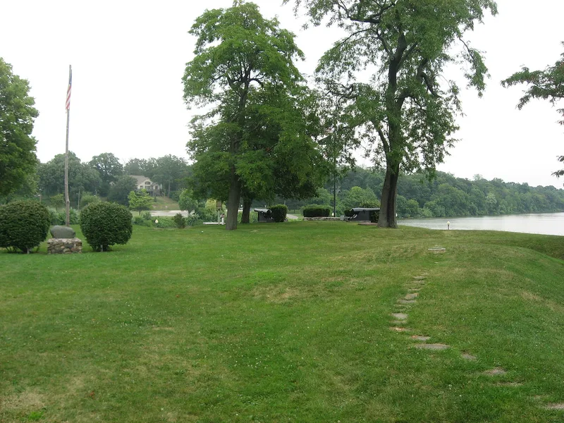
Fort Defiance Park occupies the point where the Auglaize River meets the Maumee River in Defiance, Ohio. The land was the site of Fort Defiance, built between August 9 and September 14, 1794, during General Anthony Wayne's campaign against a British-supported Indian force. Major Henry Burbeck directed the first phase, a stockaded fort with corner blockhouses. After the victory at Fallen Timbers, the army strengthened the post with bomb-proof vaults and a deep ditch. Wayne considered it the strongest fort he built. The fort was abandoned after 1797, and a settlement grew around it that became the city of Defiance. When the town was platted in 1835, the fort site was donated as a public area, which helped preserve the earthworks. An 1888 federal survey found them largely intact. Today the park holds tree cover, markers, two Civil War era naval guns, a flagpole and remnants of the earthworks marked by a stone path.
Significance in brief: It is the site of a principal and strategic post in the chain of forts Wayne used in his 1793-95 campaign against a British-supported Indian force. After Wayne's victory the fort represented the new American government presence in the Northwestern Territory until Ohio statehood in 1803. It also became the nucleus for the early settlement of the city of Defiance.
Machine-generated summary. This summary was generated by a language model from the official nomination document and has not been reviewed line by line by an editor. It may contain errors. Check the source document before relying on any detail. Source: nomination document (PDF) · National Archives catalog entry. NRHP reference 80002989, listed June 23, 1980. Summary generated October 2026 (model claude-sonnet-5-5, prompt v1.0-2026-10-29, confidence medium).
Key facts
| Address | Fort St., Defiance |
|---|---|
| County | Defiance County |
| Listed | June 23, 1980 |
| Reference number | 80002989 |
| Resource type | Site |
| Period of significance | 1794 |
| Architect / builder | Major Henry Burbeck |
| Areas of significance | Military, Exploration/Settlement |
| Level of significance | State |
| Status (as stated in the nomination) | Site is stable and maintained by the City of Defiance as part of its park system; remnants of the original earthworks survive, and concrete retaining walls were added along the rivers in 1936. |
| Acreage | 1.3 |
| Coordinates | 41.28754, -84.35668 (NPS GIS) |
What listing means for this property
Sites (archaeological sites, battlefields, landscapes) are often listed with a restricted address to protect them from looting or disturbance. Listing is honorary for private owners; federal undertakings on or near the site go through Section 106 review, and state laws may protect burials and artefacts regardless of listing.
General information, not legal or tax advice. Rules change; confirm with your State Historic Preservation Office or a qualified adviser.
Sources and further reading
- National Park Service, National Register of Historic Places database (snapshot May 2026), reference 80002989.
- Nomination form (PDF, National Archives) — catalog entry
- Wikipedia article (used for cross-checking only; text not reproduced here)
- Wikidata Q5471041
- This listing as JSON
Last updated October 2026. Found an error? See the editorial policy for how to report it.