Sunset Park Historic District

Why it's listed
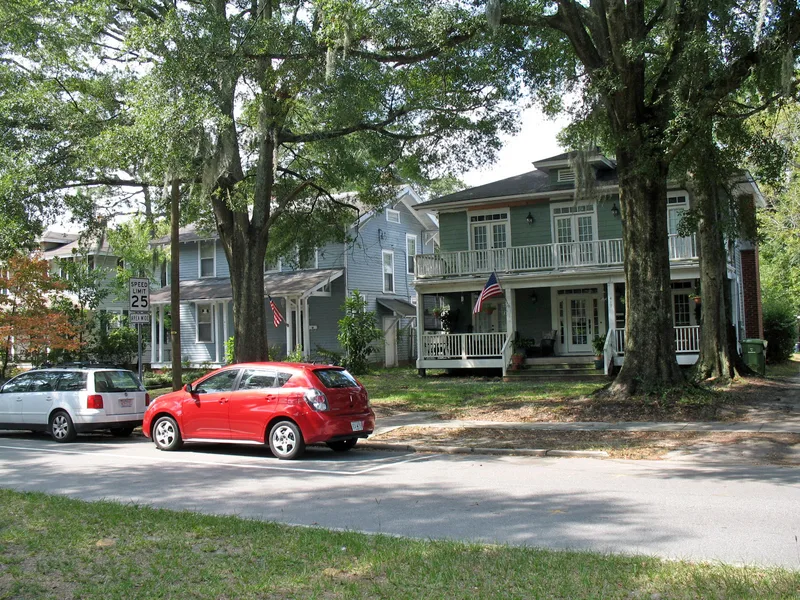
Sunset Park is a planned residential neighborhood about one mile south of downtown Wilmington, covering roughly 227 acres. The Fidelity Trust and Development Company laid it out in August 1912 on a grid of wide boulevards and narrower cross streets named for early United States presidents. Twin brick and wood pergolas at the eastern end of Northern Boulevard were built in 1912 to mark the entrance and once served as a waiting area for the trolley to Greenfield Lake and downtown. The earliest houses, on Northern and Central boulevards, include Queen Anne, Craftsman, Tudor Revival and Colonial Revival designs, while Cape Cod, minimal traditional and ranch houses fill the cross streets. Many modest homes were built for shipyard workers and their families during World War II. Two Colonial Revival churches from 1950 and 1953 also stand here. Despite siding and window replacements, the district keeps its historic character, and about 90 percent of its resources contribute to its significance.
Significance in brief: The form describes a planned streetcar-era suburb with a grid of boulevards and presidential street names, retained entrance pergolas, and a cohesive collection of houses from the 1910s to the mid-1950s. Many modest Cape Cod and minimal traditional houses were built for shipyard workers during World War II. About 90 percent of resources contribute, and the period of significance ends in 1957.
Machine-generated summary. This summary was generated by a language model from the official nomination document and has not been reviewed line by line by an editor. It may contain errors. Check the source document before relying on any detail. Source: nomination document (PDF) · National Archives catalog entry. NRHP reference 03001265, listed December 10, 2003. Summary generated October 2026 (model claude-sonnet-5-5, prompt v1.0-2026-10-29, confidence medium).
Key facts
| Address | Roughly bounded by Carolina Beach Rd., Southern Blvd., Burnett Blvd., and Sunset Ave., Wilmington |
|---|---|
| County | New Hanover County |
| Listed | December 10, 2003 |
| Reference number | 03001265 |
| Resource type | District |
| Period of significance | 1912-1957 |
| Architectural style | Bungalow/Craftsman, Colonial Revival, Queen Anne, Period Cottage, Minimal Traditional |
| Areas of significance | Architecture, Community Planning and Development |
| Level of significance | Local |
| Status (as stated in the nomination) | Largely residential and still in use; many houses have synthetic siding and replacement windows, but characteristic stylistic details and overall historic character remain intact. |
| Acreage | 227 |
| Coordinates | 34.20332, -77.94516 (NPS GIS) |
What listing means for this property
This is a historic district. Buildings within its boundary are either contributing (they add to the district's significance) or non-contributing. Owners of contributing income-producing buildings can claim the 20% federal rehabilitation tax credit; homeowners should look at state credits. National Register districts impose no design review by themselves; a local historic district ordinance, if one exists, does (the difference explained).
General information, not legal or tax advice. Rules change; confirm with your State Historic Preservation Office or a qualified adviser.
Sources and further reading
- National Park Service, National Register of Historic Places database (snapshot May 2026), reference 03001265.
- Nomination form (PDF, National Archives) — catalog entry
- Wikipedia article (used for cross-checking only; text not reproduced here)
- Wikidata Q7641326
- This listing as JSON
Last updated October 2026. Found an error? See the editorial policy for how to report it.