Burch Avenue Historic District
Also known as: West End
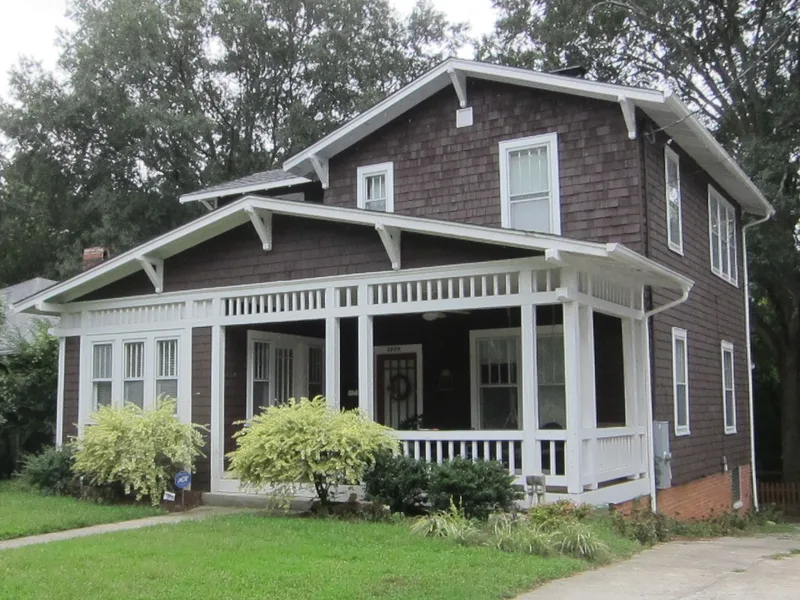

Why it's listed
Built mostly between about 1890 and 1960 on the west side of downtown Durham, North Carolina, the Burch Avenue Historic District is a residential neighborhood of about fourteen blocks. It holds 138 principal contributing buildings plus outbuildings, with houses ranging from late nineteenth-century Queen Anne homes to one-story bungalows and 1940s Minimal Traditional dwellings. The neighborhood grew as Durham's population expanded with the tobacco and textile mills and the growth of Trinity College, which became Duke University in 1924. Many early residents were contractors, carpenters, brickmakers and stone-cutters, and several built their own houses here. The district is significant for its link to that growth and for the variety of houses that show how middle-class and working-class families lived in the city during its expansion.
Significance in brief: The nomination argues the district is significant under Criterion A as an early twentieth-century city-center neighborhood that grew from Durham's population growth tied to the tobacco and textile mills and the expansion of Duke University. It is also significant under Criterion C for its range of architectural styles, from Queen Anne and Colonial Revival to Craftsman and Minimal Traditional.
Machine-generated summary. This summary was generated by a language model from the official nomination document and has not been reviewed line by line by an editor. It may contain errors. Check the source document before relying on any detail. Source: nomination document (PDF) · National Archives catalog entry. NRHP reference 10000631, listed September 3, 2010. Summary generated October 2026 (model claude-haiku-5-5, prompt v1.1-2026-10-29, confidence medium).
Key facts
| Address | Roughly bounded by S Buchanan Blvd, W Chapel Hill St, Duke University Rd, Burch Ave, and Rome Ave, Durham |
|---|---|
| County | Durham County |
| Listed | September 3, 2010 |
| Reference number | 10000631 |
| Resource type | District |
| Period of significance | C. 1890 - 1960 |
| Architectural style | Queen Anne, Bungalow/Craftsman, Colonial Revival, Triple-A, minimal traditional |
| Criteria |
|
| Areas of significance | Architecture, Community Planning and Development |
| Level of significance | Local |
| Acreage | 36 |
| Coordinates | 36.00071, -78.91610 (NPS GIS) |
What listing means for this property
This is a historic district. Buildings within its boundary are either contributing (they add to the district's significance) or non-contributing. Owners of contributing income-producing buildings can claim the 20% federal rehabilitation tax credit; homeowners should look at state credits. National Register districts impose no design review by themselves; a local historic district ordinance, if one exists, does (the difference explained).
General information, not legal or tax advice. Rules change; confirm with your State Historic Preservation Office or a qualified adviser.
Sources and further reading
- National Park Service, National Register of Historic Places database (snapshot May 2026), reference 10000631.
- Nomination form (PDF, National Archives) — catalog entry
- Wikipedia article (used for cross-checking only; text not reproduced here)
- Wikidata Q19460739
- This listing as JSON
Last updated October 2026. Found an error? See the editorial policy for how to report it.